
In Kars, Ontario, the site where the bridge once crossed the Rideau River runs from the Kars Boat Launch at the east end of Old Wellington Street to the bridge abutment, still in place at the west end of Lorne Bridge Road.


The settlement Where Stevens Creek Flows into the Rideau River was named Wellington Village around the time of the Rideau Canal's completion in 1832. Another community named Wellington in Prince Edward County on Lake Ontario south of Belleville, Ontario, caused sufficient confusion between the two communities such that mail intended for one often arrived at the other. To distinguish between them in 1857 Wellington Village on the Rideau River was renamed, Kars. The name commemorates Canadian-born General Sir William Fenwick Williams who, for the Ottoman Empire, had directed the defense of the town of Kars against the Russian Empire, in 1855, during the Crimean War.
Billy Richardson operated a ferry from the 1860s that linked North Gower and Osgoode Township at Kars. By 1866, Kars was a post village on the Rideau River with a population of 200, part of the North Gower Township. The Ottawa and Prescott Railway ran east of the Rideau River about a mile from Kars on a thoroughfare now occupied by the Osgoode Link Pathway — now the Doug Thompson Pathway.
Billy Richardson operated a ferry from the 1860s that linked North Gower and Osgoode Township at Kars. By 1866, Kars was a post village on the Rideau River with a population of 200, part of the North Gower Township. The Ottawa and Prescott Railway ran east of the Rideau River about a mile from Kars on a thoroughfare now occupied by the Osgoode Link Pathway — now the Doug Thompson Pathway.
Local residents had discussed construction of a bridge over the Rideau River at Kars during the 1860s and 1870s. Members of North Gower and Osgoode townships generally agreed on the need for a bridge. Negotiation with the federal government of Canada eventually, in 1877, arranged for 7% financing from the, then in power, Reform Party, with the balance coming from the Russell and Carleton Counties.
On the east side of the Rideau River the bridge on ramp was located on the property of James Cullen, at the end of what is now Lorne Bridge Road. On the west side access to the bridge was from what is now Old Wellington Street where the Kars Boat Launch is now located.
Contractor, Thomas Bingham, son of Samuel Bingham (sometime mayor of Ottawa), built the bridge. The new Lorne Bridge opened on Tuesday, November 19, 1878. It was named after the current Governor of Canada, The Marquis de Lorne who served from 1878 to 1883. Stephen Martin served as the first bridgemaster, succeeded by McKenzie Eastman. The Lorne Bridge was removed after the completion of the fixed bridge on Roger Stevens Drive in 1961.

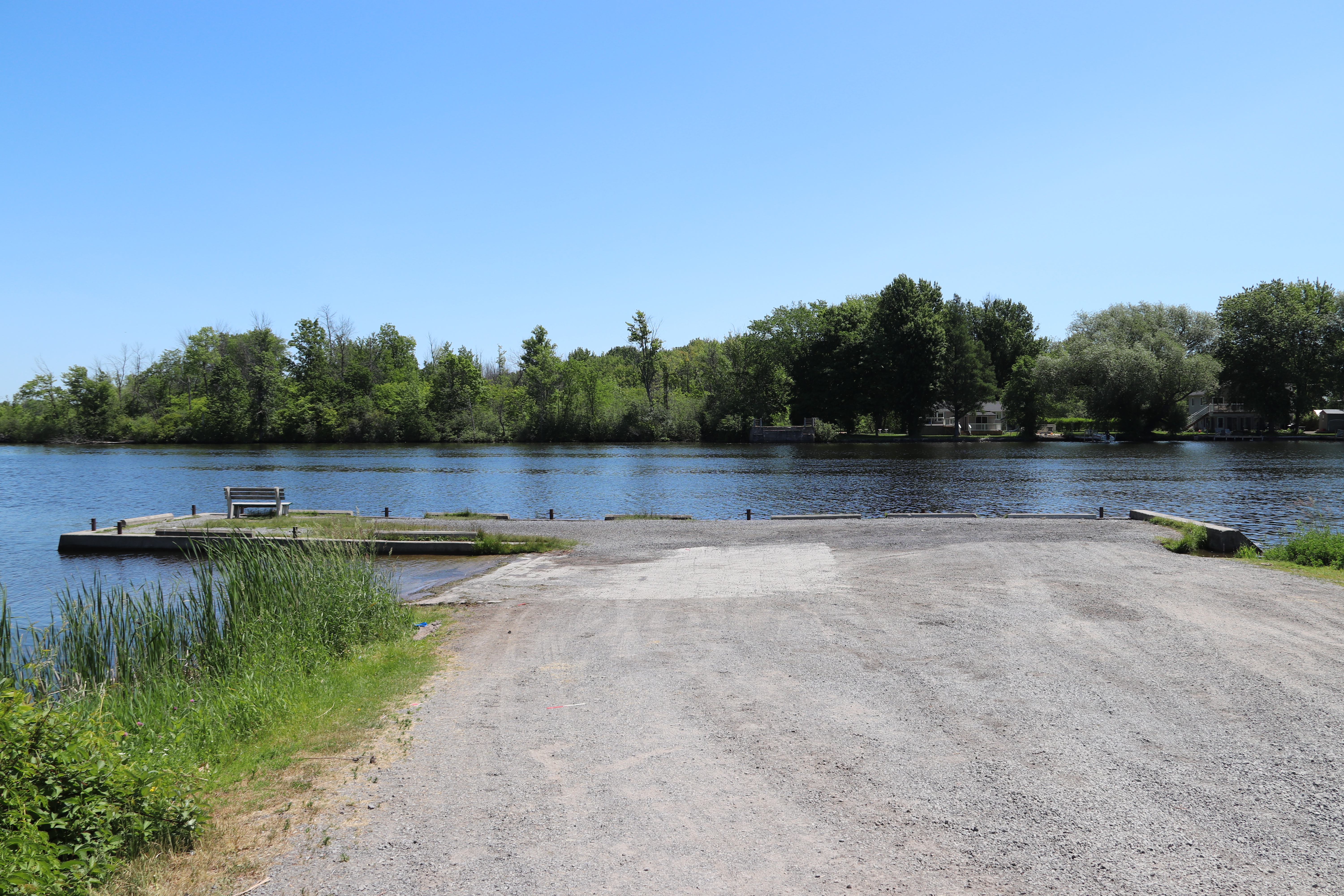


This detail map on the Rideau Canal charts brought this site to my attention. With no depth less than 6 feet on the chart and no structure to inhibit passage of vessels travelling the Rideau Canal system I wondered why this detail map appeared on the charts. The two circles indicating a depth of 9 feet between the boat launch and the bridge abutment on the other side, must be the remnants of bridge supports.


The Roger Stevens Drive / Ottawa Regional Road 6 bridge over the Rideau River made the swing bridge at Kars unnecessary.


This is the Lorne Bridge that occupied this site. The rectangular structure at the far end indicates the location of the swing bridge. A number of lockstations shown on this blog site have swing bridges built from the same plans.


