Burritts Rapids Lockstation occupies a location on the Rideau Canal system on the Rideau River north of River Road about .4 kilometres (.25 miles) east of Burritts Rapids Road.
Parks Canada
Rideau Canal
National Historic Site of Canada
Burrits Rapids Lock
Parcs Canada
Canal-Rideau
Lieu historique national du Canada
Écluse de Burritts Rapids
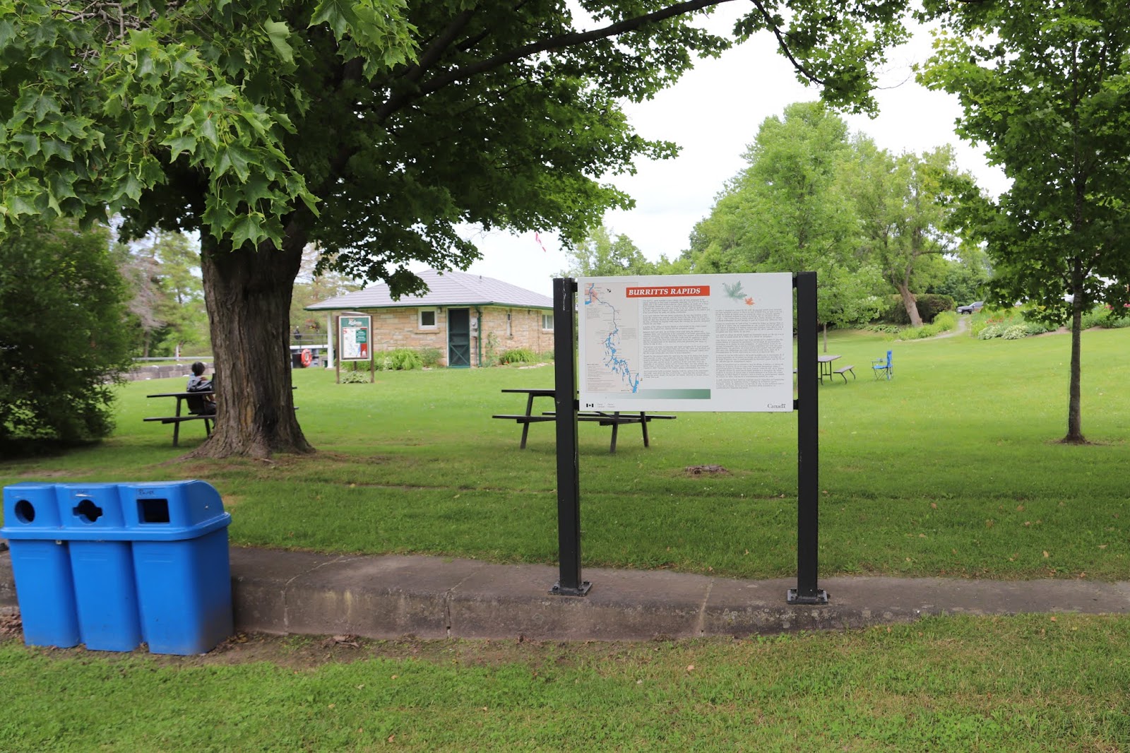
BURRITTS RAPIDS
This lock is a good example of how Colonel John By took advantage of the natural landscape to help build a navigable waterway. The lock is at the foot of the Oxford Snie, a dry ravine which acted as a flood channel. By made use of these flood channels, known as "snies" in several locations along the Rideau. It allowed the construction of the lock to be "in the dry", with the water flowing by in the original river channel. Only a small dam was needed at the bottom end of the lock to keep the water out during construction.
At the same time the lock was being constructed, By was also building a dam across the original river channel, near the head of the snie. When his lock was ready, the dam was raised to the required water depth and creating the peaceful navigation channel we see today.
A portion of the Village of Burritts Rapids is now located on the island created between the original river channel and the navigation channel.
Between 1826 and 1832, an old Indian canoe route along the Rideau and Cataraqui Rivers was transformed at the command of the British government from untamed wilderness rivers into the Rideau Canal. The purpose of this remarkable artery was to provide the British army with a safe route for supplying its inland garrisons, avoiding the direct but exposed route along the St. Lawrence, which only the disorganization of the American forces had prevented from being cut during the War of 1812.
The 202 km (126 miles) of waterway was made navigable by 47 locks grouped in 24 stations with their associatd dams and weirs. The word was designed and superintended by the Royal Engineers, commanded by Lieutenant Colonel John By; the actual construction was done by local contractors.
Despite the blockhouses along the waterway, the role of hte Rideau has always been peaceful. It was a busy waterway, carrying settlers and supplies into the growing settlement of the interior intul the middle of the 19th century, when larger locks were opened on the St. Lawrence. At the same time, since the possibility of war between Britain and the United States was now unlikely, the British Board of Ordnance signed the system over to the colonial government of Canada in 1856. The period of the Canal's military administration was over.
Local commercial traffic remained important until the advent of the automobile and better roads about the time of World War 1. Since that time recreational boating has grown steadily so that now the system, well into its second century, is busier than ever.

BURRITTS RAPIDS
On-yott ici comment le colonel By tira profit du paysage naturel pour construire une voie navigable. L'écluse se trouve au pied d'Oxford Snie, un ravin à sec qui servit de chenal de hautes eaux. Le colonel By utilisa ces chenaux appelés « snies » à plusieurs endroits le long de la Rideau afin de construire l'écluse « à sec », l'eau coulant dans le chenal naturel de la rivière. Pendant les travaux, il suffisait d'aménager un petit barrage en aval de l'écluse pour détourner l'eau.
Pendant la construction de cette écluse, le colonel By érigea un barrage dans le chenal de la rivière, près de l'embouchure du snie. Lorsque l'écluse fut prête, il a suffi d'élever le barrage à la hauteur requise pour repousser l'eau dans le snie et ainsi obtenir la profondeur voulue. C'est ainsi que fut créé le paisible chenal de navigation que nous voyons de nos jours.
Une partie du village de Burritts Rapids est maintenant située sur l'île qui a vu le jour entre le chenal naturel de la rivière et le chenal de navigation.
Entre 1826 et 1832, une ancienne voie d'eau utilisée par les Indiens le long des rivières Rideau et Cataraqui fut transformée à la demande du gouvernement britannique en un réseau de voies navagables : le canal Rideau. Le but de cet ouvrage remarquable était de fournir à l'armée britannique une route sûre pour approvisionner ses garnisons. On évitait ainsi le Saint-Laurent, voie plus directe mais oussi plus dangereuse qui n'était demeurée ouverte qu'en raison de la désorganisation de l'armée américaine au cours de la guerre de 1812.
Le réseau de 202 km (126 milles) a été rendu navigable par la construction de 47 écluses regroupées en 24 postes. Les travaux ont été planifiés et surveillés par les Royal Engineers. Sous le commandement du lieutenant-colonel John By. Ils ont été exécutés par des entrepreneurs locaux.
Malgré les blockhaus qui se trouvent le long du réseau, le Rideau n'a jamais été troublé par la guerre. Ce fut un cours d'eau achalandé transportant colons et approvisionnement à l'intérieur des terres jusq'au milieu de XIXe siècle lorsque les grandes écluses du Saint-Laurent furent ouvertes à la navigation. Au même moment, la menace de guerre entre la Grande-Bretagne et les États-Unis s'étant estompée, le British Board of Ordnance céda le réseau au gouvernement colonial du Canada en 1856. Ceal mit fin à l'administration militaire du canal.
Le trafic commercial local demeura important jusqu'à l'apparition de l'automobile et la construction de meilleurs routes à l'époque de la Première Guerre mondiale. Depuis, les plaisanciers se sont faits de plus en plus nombreux, tant et si bien qu le réseau, qui en est à son deuxième siècle d'existence, et maintenant plus fréquenté que jamais.
Rideau Canal
Parks Canada
Welcome
The
Rideau Canal is North America's oldest continually operating canal.
This 202 km (125 mi) long chain of lakes, rivers and canal cuts is one
of nine historic canals in Canada. Originally built between 1826-32 for
military defence, the Rideau Canal is now maintained and operated by
Parks Canada as an historic recreational waterway.
Canal Rideau
Parcs Canada
Bienvenue
Le canal Rideau est le plus vieux canal en exploitation ininterrompue d'Amérique du Nord. Cette succession de lacs, de rivières et de canaux, qui s'étire sur 202 kilomètres (125 milles), est l'un des neuf canaux historiques du Canada. Le canal Rideau a été construit de 1826 à 1832 pour assurer la défense du pays. Cette voie navigable historique à caractère récréatif est maintenant exploitée par Parcs Canada.
History weaves its web...
The land shapes people and people shape the land.
Burritt's Rapids stands as a reminder that for over 200 years major changes have taken place in this area, both to the landscape and to the people.
In 1793, the Burritt brothers settled here. These first settlers cleared the land and used the existing water power for a grist mill. The settlement was isolated in the wilderness, the only means of communication was a canoe route.
The Rideau Canal accelerated the development of this area. The excavation of a natural depression created a channel. Stone walls replaced some earth embankments, a dam controlled the water flow and a bridge was built. Here was a transportation route more than 200 kilometres (125 miles) long connecting the wilderness to the existing civilization.
The construction of the Rideau Canal (1826-1932) changed life along the river. More mills were built using the harnessed waterpower of the canal. Families came by steamboat along that grand new water "highway". The forests yielded to fields, houses, roads and business: a community took root. The village of Burritt's Rapids flourished.
In a country the size of Canada, transportation is the key to growth. In the late 1850s another change affected Burritt's Rapids. A new and faster mode of transportation - the railway - contributed to the decline of the local economy. The Bytown and Prescott railway had bypassed Burritt's Rapids!
History weaves its web over the land. The evolution of the land has been gentle, people can again enjoy the tanquility of a heritage landscape far removed from teh bustle of the late 20th century.
Experience the evolution of Burritt's Rapids, walk the Tip to Tip Trail where a special blend of nature and history are illustrated along the two kilometre (1.25 mile) length.
L'histoire tisse sa toile...
Le paysage façonne les gens, et les gens façconnent le paysage.
Le village de Burritt's Rapids témoigne des changements profonds qui affectent les habitants et lieux environnants depuis 200 ans.
En 1793, les frères Burritt s'établirent ici. Ces pionniers défrichèrent la forêt et utilisèrent l'énergie hydraulique pour actionner un premier moulin. Isolés dans une contrée sauvage, ils n'avaient que le canot pour communiquer avec l'extérieur.
Le canal Rideau accéléra le développement de cette région. Le creusement d'une dépression naturelle créa le chanal. Des murs en pierre remplacèrent certaines berges, le débi de l'eau fut régularisé par un barage et un pont fut érigé. Une voie navigable de plus de 200 kilomètres (125 milles) reliait dorénavant ce coin reculé à la civilisation.
La construction du canal Rideau (1826-1832) changea la vie des riverains. De nouveaux moulins bénéficièrent de la puissance hydraulique de la rivière. Des familles vinrent en bateau à baperu s'installer le long dea la nouvelle « grand-route ». Les forêts firent place aux champs, aux habitations, aux routes et aux enterprises. Une communauté prit racine. Ce fut l'apogée du village de Burritt's Rapids.
Dans un pays aussi vaste que le Canada, les transports sont la clé de la croissance. Un peu avant 1860, un nouveau mode de transport plus rapide, le train, contribua au déclin de l'economie locale. En effet, la voie ferrée de la Bytown et Prescott avait contoumé le village!
Et l'histoire tisse sa toile. Ici, l'évolution s'est faite en douceur et les gens peuvent profiter en toute quiétude d'un canal historique, éloigné de l'animation de la fin du XX
e siècle.
Vous êtes invité à parcourir les deux kilomètres (1.2 mille) du Sentier de l'île où l'histoire et la nature s'harmonisent.