The Smiths Falls Lockstation occupies the central core of Smiths Falls, running from west of Abbott Street North and east of Brockville Street South.
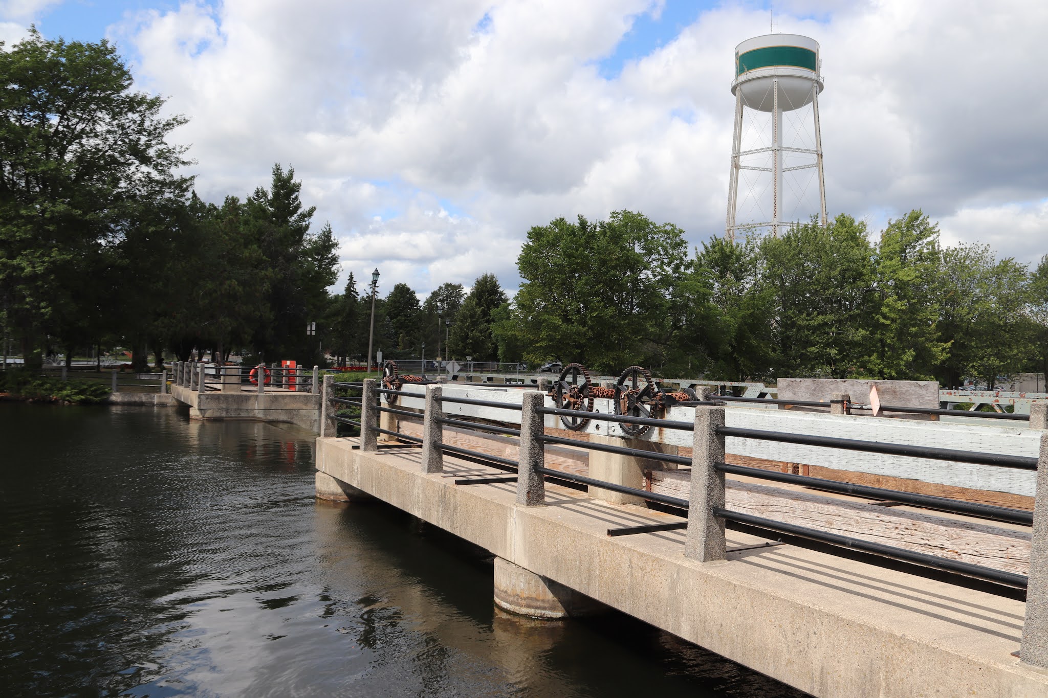
The locks in Smiths Falls actually occupy two lockstations, the Combined Lockstation with lock 29a, and the Smiths Falls Detached Lockstation with lock 31, which will be featured in another post. The combined lock, 29a replaced the original three Smiths Falls locks: 28,29, and 30. They are no longer in use but were kept for the sake of their historic legacy.
This post will first deal with Smiths Falls' dams and waste water weirs starting in the west, then following the flow of water to the east, north around the Rideau Canal Headquarters and visitor centre (featured in another post) and then downstream from the complex. It will then come back from the east, showing the closed locks, 28, 29 and 30, and finish off detailing the combined lock, 29a, which provides a lift of 7.9 m (26 ft.).


Combined Lock / Foster's Lock
the Combined Locks, also known as Foster's Locks, were named after a local well-known businessman, Adam Foster. During the 1960's there was discussion in the municipality to install an electrically operated single lock just upstream from the Combined Locks, and then to destroy these locks, which had been in place for over a century. Fortunately, in the early 1970's, a decision was made to build the new Combined Locks, where are the only automated and deepest locks on the Rideau Canal system, while at the same time preserving the old locks as part of our heritage.

Les Écluses Combinées / Écluses Foster
Les écluses combinées (« The Combined Locks ») connues sous le nom des écluses Foster, ont été nommées en hommage à un homme d'affaires bien connu, Adam Foster. Au cours des années 1960, la municipalité a envisagé d'installer une écluse unique à commande électrique, juste en amont des écluses combinées, puis de détruire ces écluses, en place depuis plus d,un siècle. Heureusement, au début des années1970, il a été décidé de construire les nouvelles écluses combinées, qui sont les seules écluses automatisées et les plus profondes du réseau du Canal Rideau, tout en présearvant les anciennes écluses dans le cadre de notre patrimoine.


Automated Lock
The new lock at Combined, opened in 1974, is one of three automated locks on the Rideau Canal. The basic principle of locking through boats by raising and lowering water levels is the same for all the locks, but the operating mechanisms that allow the water in and out of the lock chamber are different. In manually operated locks, Parks Canada staff crank winches using brute strength to open and close gates and sluice valves. At this automated lock, staff push buttons to operate electrically the hydraulic valves that open and close the gates and sluices.

Une écluse automatique
La nouvelle écluse combinée ouverte en 1974 est l'une des trois écluses automatiques du canal Rideau. Touts les écluses fontionnent selon la même principe de base: il s'agit d'élever et d'abaisser le niveau de l'eau pour permettre l'éclusage des embarcations. Cependant, les mécanismes qui font entrer et sortir l'eau des sas peuvent différer. Dans le cas des écluses à fonctionnement manuel, le personnel actionne les treuils à bras pour déplacer les chaînes fixées aux portes eet aux vannes d'écluse afin de les ourir et de les fermer. Ici, le personnel de l'écluse automatique se contente d'appuyer sur des boutons afin d'actionner électriquement les valves hydraliques qui ouvrent et ferment les portes et les vannes.


SMITHS FALLS
The 3 locks here were designed to overcome a series of rapids with a total fall over 7 metres (20 feet). A set like this is known as a flight of locks – each lock raises a vessel part of the way – rather like a stairway. Construction here proved more difficult that Colonel By had expected. Cracks were discovered in the stone walls of the basin leading the single lock a quarter mile upstream. Thes had to be filled in and extra work meant that the final cost of this station was more than twice the original estimate. It cost £36,000 which today would be about one million dollars.
Like Merrickville, Smiths Falls was a busy industrial centre in the 19th century with flour, shingle and sawmills as well as several foundries. One of the most famous was the Frost & Wood Manufacturing Company which operated for more than a century producing farm machinery. The town is still and important junction of the Canadian Pacific mainline between Toronto and Montreal and even in the 20th century, barges came up the Rideau from Kingston carrying coal for the railways.
Between 1826 and 1832, an old Indian canoe route along the Rideau and Cataraqui Rivers was transformed at the command of the British government from untamed wilderness rivers into the Rideau Canal. The purpose of this remarkable artery was to provide the British army with a safe route for supplying its inland garrisons, avoiding the direct but exposed route along the St. Lawrence, which only the disorganization of the American forces had prevented from being cut during the War of 1812.
The 202 km (126 miles) of waterway was made navigable by 47 locks grouped in 24 stations with their associated dams and weirs. The word was designed and superintended by the Royal Engineers, commanded by Lieutenant Colonel John By; the actual construction was done by local contractors.
Despite the blockhouses along the waterway, the role of the Rideau has always been peaceful. It was a busy waterway, carrying settlers and supplies into the growing settlement of the interior until the middle of the 19th century, when larger locks were opened on the St. Lawrence. At the same time, since the possibility of war between Britain and the United States was now unlikely, the British Board of Ordnance signed the system over to the colonial government of Canada in 1856. The period of the Canal's military administration was over.
Local commercial traffic remained important until the advent of the automobile and better roads about the time of World War 1. Since that time recreational boating has grown steadily so that now the system, well into its second century, is busier than ever.

SMITHS FALLS
Les trois écluses de Smiths Falls ont été conçues pour éviter une série de rapides d'une dénivellation totale de 7 mètres (20 pieds). Elles permettent aux embracations de passer d'un niveau d'eau à un autre. Chacune d'elles élevant les embarcations à divers paliers, un peu comme des escaliers. La construction s'ext révélée plus difficile que ne l'avait pensé le colonel By. Des fissures sont apparues sur les murs de pierre du bassin conduisant à l'écluse détachée, à quelque 400 mètres en amont. Elles ont dû être réparées, ajoutant ainsi au coût total du projet, si bien qu'à la fin des travaux, les écluses avaient coûté £36,000, ce qui équivaut aujourd'hui à près d'un million de dollars.
Tout comme Merrickville, Smiths Falls a été un centre commercial au XIXe siècle avec des neuneries, des usines de bardeau, des scieries et des fonderies. L'une des entreprise les plus connues a été la Frost & Wood Manufacturing, qui a fabriqué des équipement de ferme pendant plus de 100 ans. La ville est encore un important point de raccordement sur la voie principale du Canadien Pacifique reliant Toronto et Montréal. Même au début de XXe siècle, des barges remontaient le Rideau en provenance de Kingston, trasportant du charbon pour les chemins de fer.
Entre 1826 et 1832, une ancienne voie d'eau utilisée par les Indiens le long des rivières Rideau et Cataraqui fut transformée à la demande du gouvernement britannique en un réseau de voies navagables : le canal Rideau. Le but de cet ouvrage remarquable était de fournir à l'armée britannique une route sûre pour approvisionner ses garnisons. On évitait ainsi le Saint-Laurent, voie plus directe mais oussi plus dangereuse qui n'était demeurée ouverte qu'en raison de la désorganisation de l'armée américaine au cours de la guerre de 1812.
Le réseau de 202 km (126 milles) a été rendu navigable par la construction de 47 écluses regroupées en 24 postes. Les travaux ont été planifiés et surveillés par les Royal Engineers. Sous le commandement du lieutenant-colonel John By. Ils ont été exécutés par des entrepreneurs locaux.
Malgré les blockhaus qui se trouvent le long du réseau, le Rideau n'a jamais été troublé par la guerre. Ce fut un cours d'eau achalandé transportant colons et approvisionnement à l'intérieur des terres jusq'au milieu de XIXe siècle lorsque les grandes écluses du Saint-Laurent furent ouvertes à la navigation. Au même moment, la menace de guerre entre la Grande-Bretagne et les États-Unis s'étant estompée, le British Board of Ordnance céda le réseau au gouvernement colonial du Canada en 1856. Ceal mit fin à l'administration militaire du canal.
Le trafic commercial local demeura important jusqu'à l'apparition de l'automobile et la construction de meilleurs routes à l'époque de la Première Guerre mondiale. Depuis, les plaisanciers se sont faits de plus en plus nombreux, tant et si bien qu le réseau, qui en est à son deuxième siècle d'existence, et maintenant plus fréquenté que jamais.


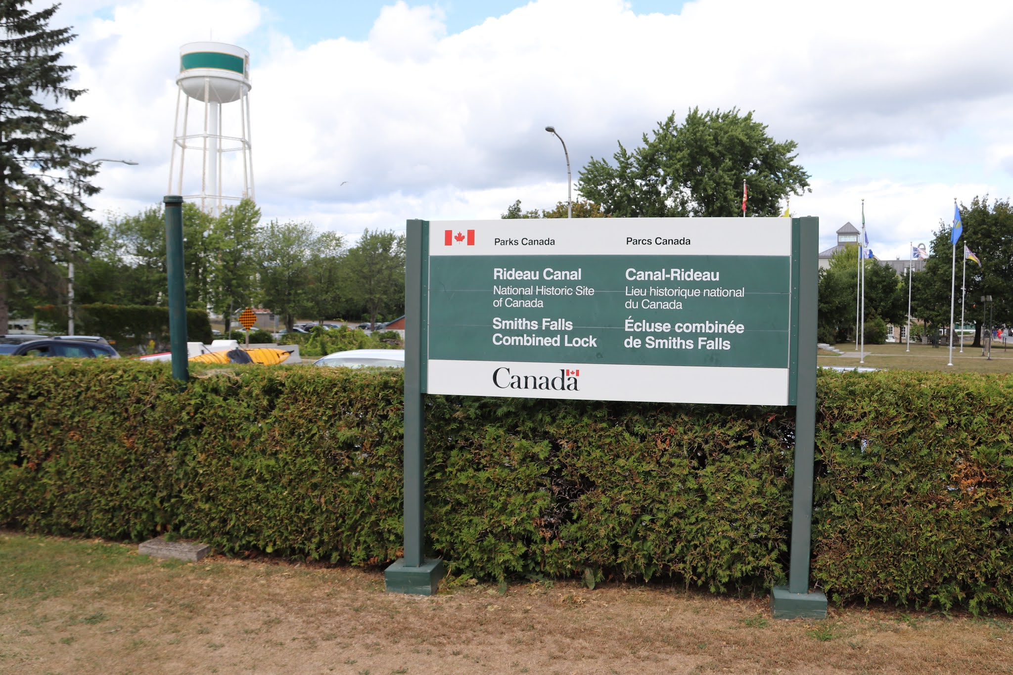
Parks Canada
Rideau Canal
National Historic Site of Canada
Smiths Falls Combined Lock
Parcs Canada
Canal-Rideau
Lieu historique national du Canada
Écluse combinée de Smiths Falls


Welcome to Combined Locks
This lockstation is one link in the chain of rivers, lakes and waterway structures that make up the Rideau Canal. Built under the direction of the British military between 1826 and 1832 to serve as a supply route, the canal is an outstanding example of 19th century ingenuity in the fields of construction and engineering. A large number of original canal structures are still in existence today.
Here at Combined Locks, old and new canal technology stand side by side. The original flight of three locks was completed in 1831. These were replaced by a single automated lock in 1974 when a fixed bridge was constructed over the canal to accommodate increasing automobile traffic. The old locks, while not operational, have been preserved for viewing. By crossing the locks and following the pathway beneath the bridge you will find another piece of the lockstation's past, a defensible lockmaster's house constructed in 1841.
The Rideau Canal is part of Canada's family of National Historic Sites. It is maintained and operated by Parks Canada.
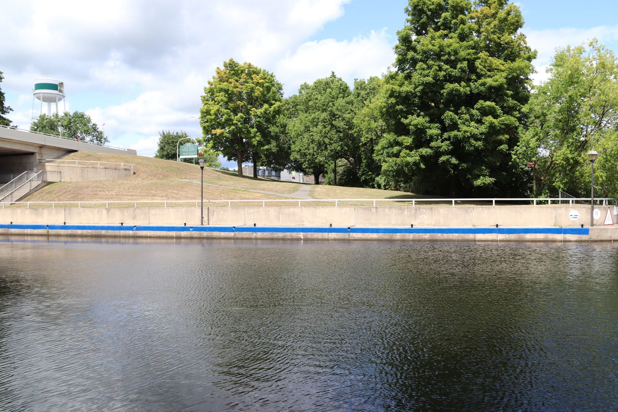
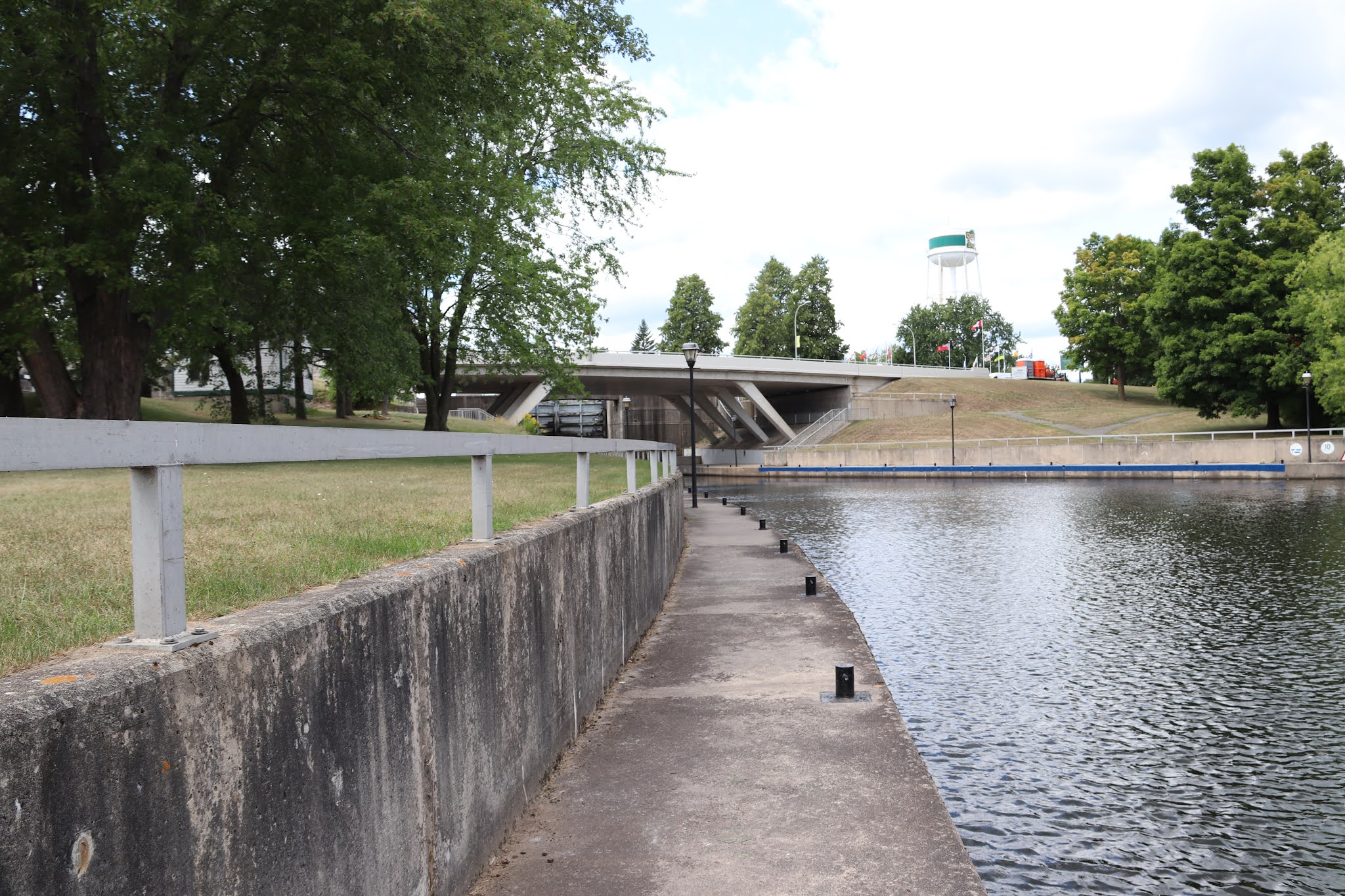
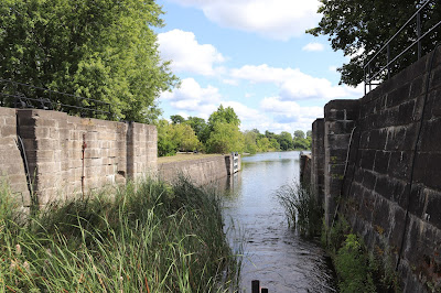
At Smiths Falls, the Rideau River descends almost 11 metres in less than ½ kilometre. To make that drop navigable, canal engineers designed an upper, detached lock connected to a long basin and three lower locks emptying into the next reach. A waste weir and a 7-metre-high stone arch dam were built on the north side of the basin to control the water level.

Bienvenue à l'écluse combinée
Ce poste d'éclusage fait partie des nombreux cours d'eau, lacs et structures qui forment le canal Rideau. Construit sous la directions des militaires britanniques entre 1826 et 1832 pour servir de voie d'approvisionnement, le canal est un témoignage exceptionnel de l'ingénuité déployée au XIXe siècle dans le domaine de la construction et du génie. Une bonne partie des structures d'origine du canal sont encore en place de nos jours.
Ici, à l'écluse combineée, l'ancien et le moderne se côtoient. L'échelle de trois écluses original, terminée en 1831, a été remplacée par une unique écluse automatisée en 1974, lorsqu'un pont fixe a été érigé au-dessue du cnal pour accommoder la circulation automobile de plus en plus dense. Les anciennes écluses et en suivant la pite sous le pont, vous trouverez en autre vesige du passé du poste d'éclussage : la résidence fortifiée du maître éclusier, bâtie en 1841.
Le Canal-Rideau, dont l'entretien et l'exploitation sont assurés par Parcs Canada, fait partie de la grande famille des lieux historiques nationaux du Canada.
À Smiths Falls, la rivière Rideau descend de preque 11 mètres sur moins d'un demi-kilomètre. Pour rendre cette dénivellation navigable, les ingénieurs du canal ont conçu en amont une écluse détachée reliée à un long bassin et, en aval, trois écluses se déversant dans le bief suivant. Un déversoir et un barrage-voûte en pierre de 7 mètres de hauteur on été construits sur la rive nord du bassin pour contrôler le niveau de l'eau.

Crossroads of the Rideau
Canal, rail and highway converge at Smiths Falls, the crossroads of the Rideau corridor. Each means of transport, built in turn, changed the face of the town, the Rideau River, and this lockstation. Canal construction first transformed the landscape, damming the river's main channel near the present-day location of the Smiths Falls water tower and creating the basin above the locks.
After the canal was built, the rapids in the waste channel were harnessed to drive grist mills and sawmills. A small village grew up around the site and by 1846 Smiths Falls had a population of 700 people along with an increasing number of mills, factories and businesses. The canal was central to this early development, with the shipment of local flour and potash to Montreal and the influx of finished products brought by steamers and barges.
In 1884 Smiths Falls becmae an important railway divisional point on the CPR's Ontario route. The railway, a year-round mode of transportation, replaced the canal as the town's most important link to the rest of the country.
the age of the automobile further transformed Smiths Falls and this lockstation. The bridge over the locks was rebuilt several times to accommodate increasing traffic. A new automated lock was required when the present low-level concrete bridge was constructed. This altered the character of the lockstation, placing side by side the old and the new.

À la croisée des chemins
C'est à Smiths Falls que le canal, la route et la chemin de fer convergent. Chacune de ces voies de passage, construites à de périodes différenetes, a modifié le visage de la ville, la rivière Rideau et le poste d'éclusage. Le paysage a été transformé par la construction du canal, d'abord par l'aménagement d'un barrage sur le chanal principal de la rivière près de l'emplacement actuel de la tour d'eau de Smiths Falls pour créer le bassin en amont des écluses.
Après la construction du canal, les eaux des rapides qui déferlaient par le déversoir furent utilisées pour faire fonctionner les minoteries et les scieries. Un petit village surgit autour et en 1846, Smiths Falls comptait 700 habitants et un nombre grandissant de moulins et d'usines, de fabriques et de commerces. Le canal fut au cœur de ce développement en permettant le transport, par vapeaurs et chalands, de la farine et de la potasse à Montréal et des produits finis à Smiths Falls.
En 1884, Smiths Falls devint une importante localité divisionnaire sur l'itinéraire ontarien du CP.
Le chemin de fer, un moyen de transport utilisé à l'année, remplaça le canal comme lien le plus important entre le village et le reste du pays.
L'arrivée de l'automobile fit de Smiths Falls une ville moderne et changea le visage de ce poste d'éclusage. Le pont enjambant les écluses fut amélioré et refait plusieurs fois afin de pouvoir supporter un trafic croissant. La construction de l'actuel pont de béton rendit nécessaire l'installation d'une nouvelle écluse automatique. L'aspect du poste d'éclusage en fut modifié, l'ancien et le moderne se côtoyant.