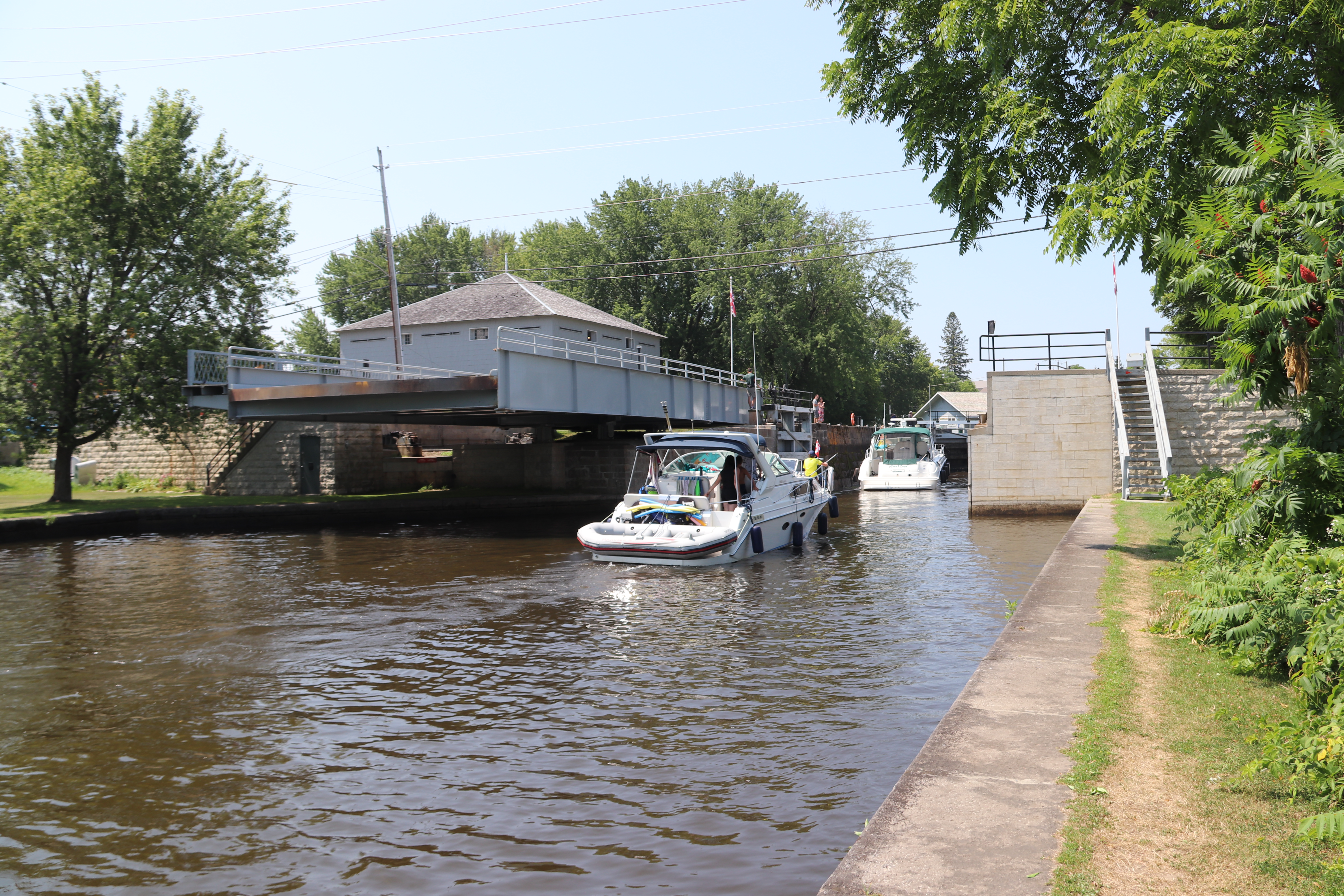
When I arrived a the Merrickville Lockstation Ontario Waterway Cruises' Kawartha Voyageur occupied lock 21. It features prominently in this post. I have edited my photographs to make geographical sense rather than to maintain a time sequence. For that reason some of the pictures with Kawartha Voyageur in them will be out of time order.
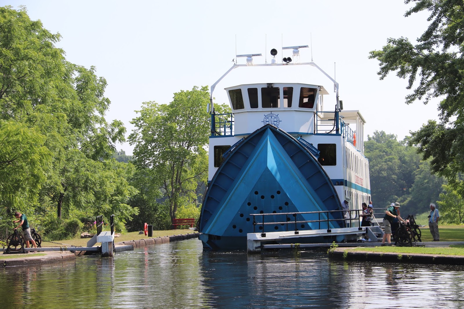


Despite seeing a lock worker taking a short sit down break, make no mistake, all the lock workers on the canal work very hard.


Parks Canada
Rideau Canal
National Historic Site of Canada
Merrickville Locks

Parcs Canada
Canal-Rideau
Lieu historique national du Canada
Écluses de Merrickville


The Merrickville Blockhouse, built for the defense of the Merrickville Lockstation is dealt with in more detail in an earlier post on this blog site, and revisited with a look at the very interesting museum inside it.


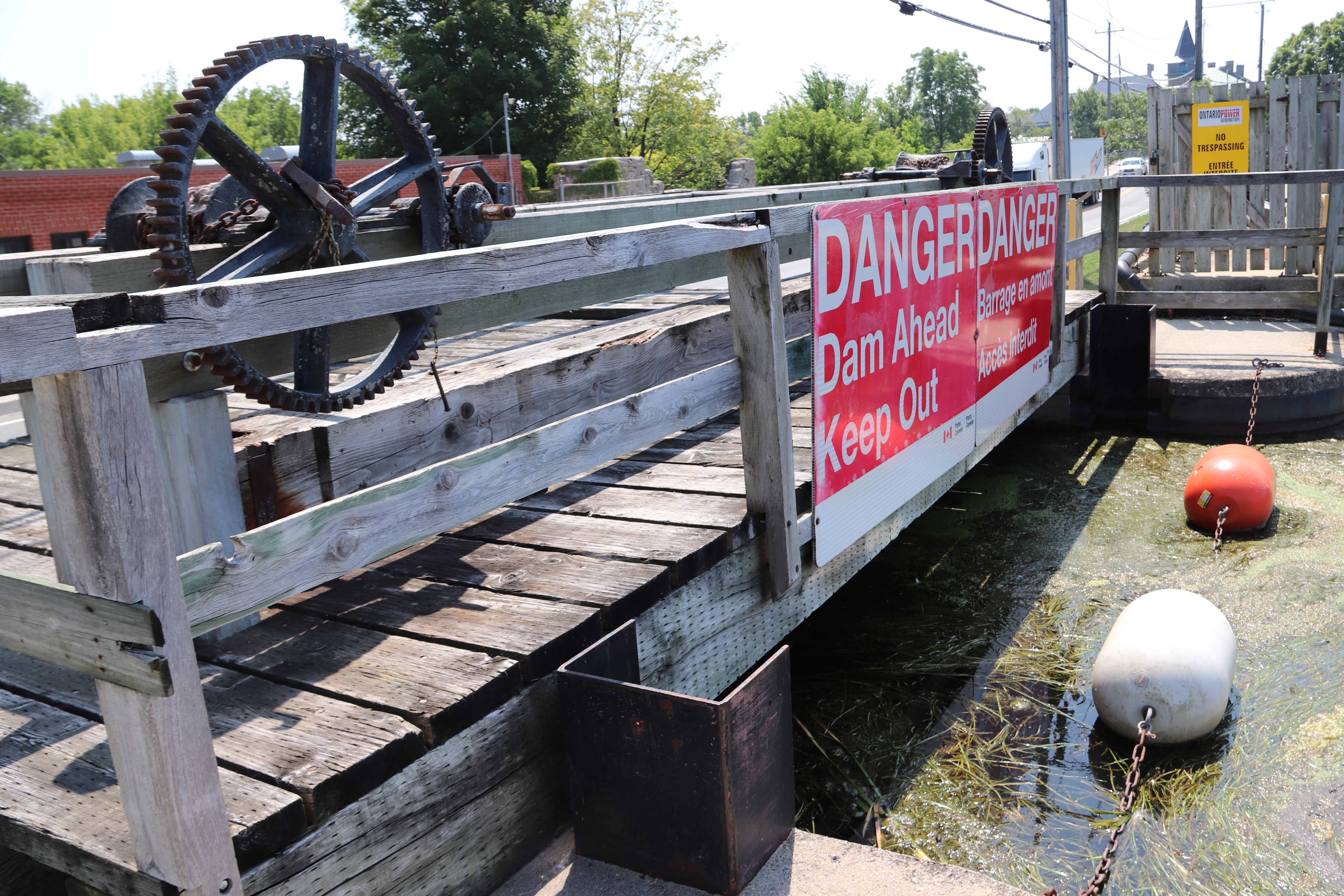
This is the upstream side of the weir. The dam runs for some length here. A power generator occupies a location to the north of the weir. I could not get to a location where I could photograph the downstream side of either facility, due to thick vegetation.


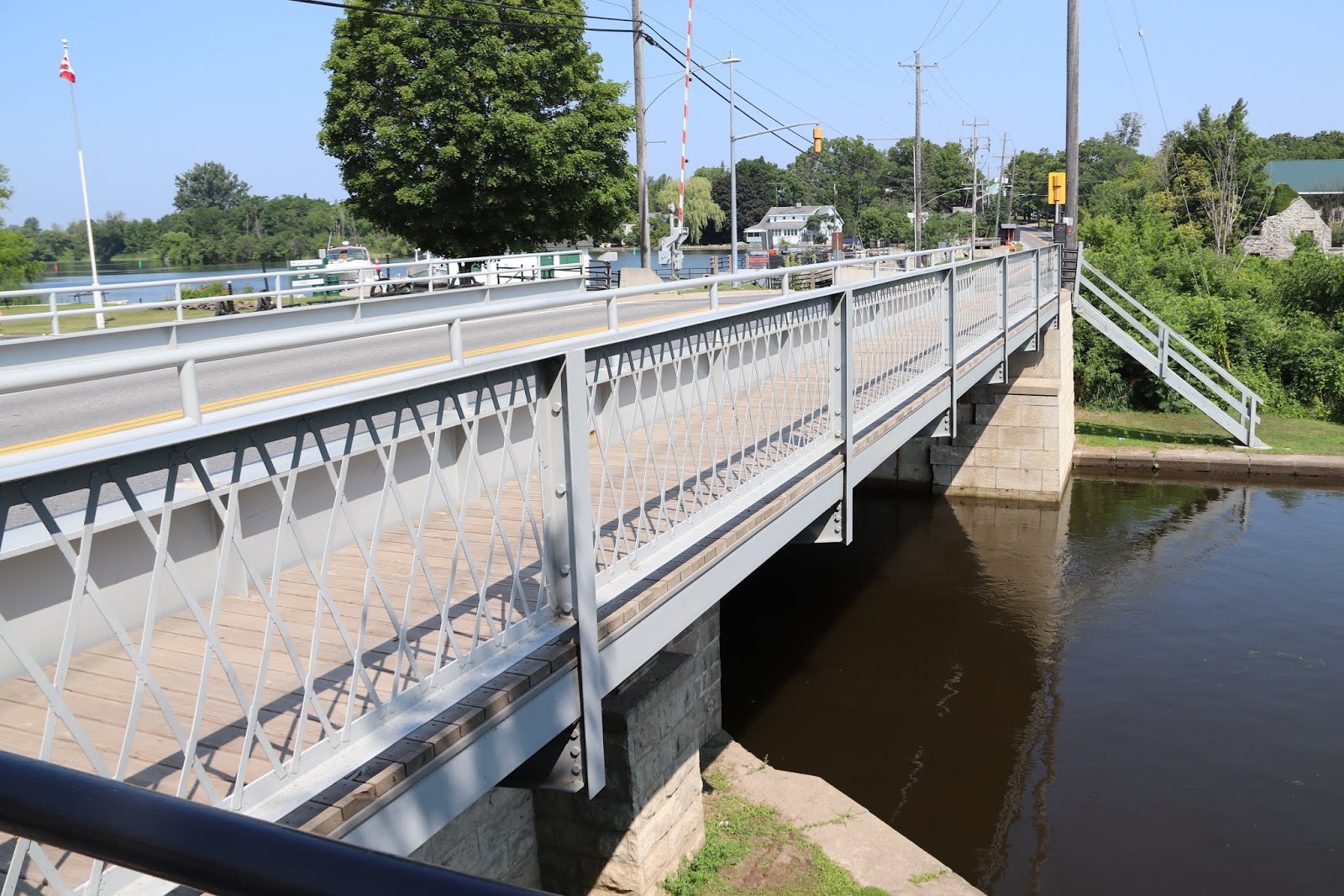


MERRICKVILLE
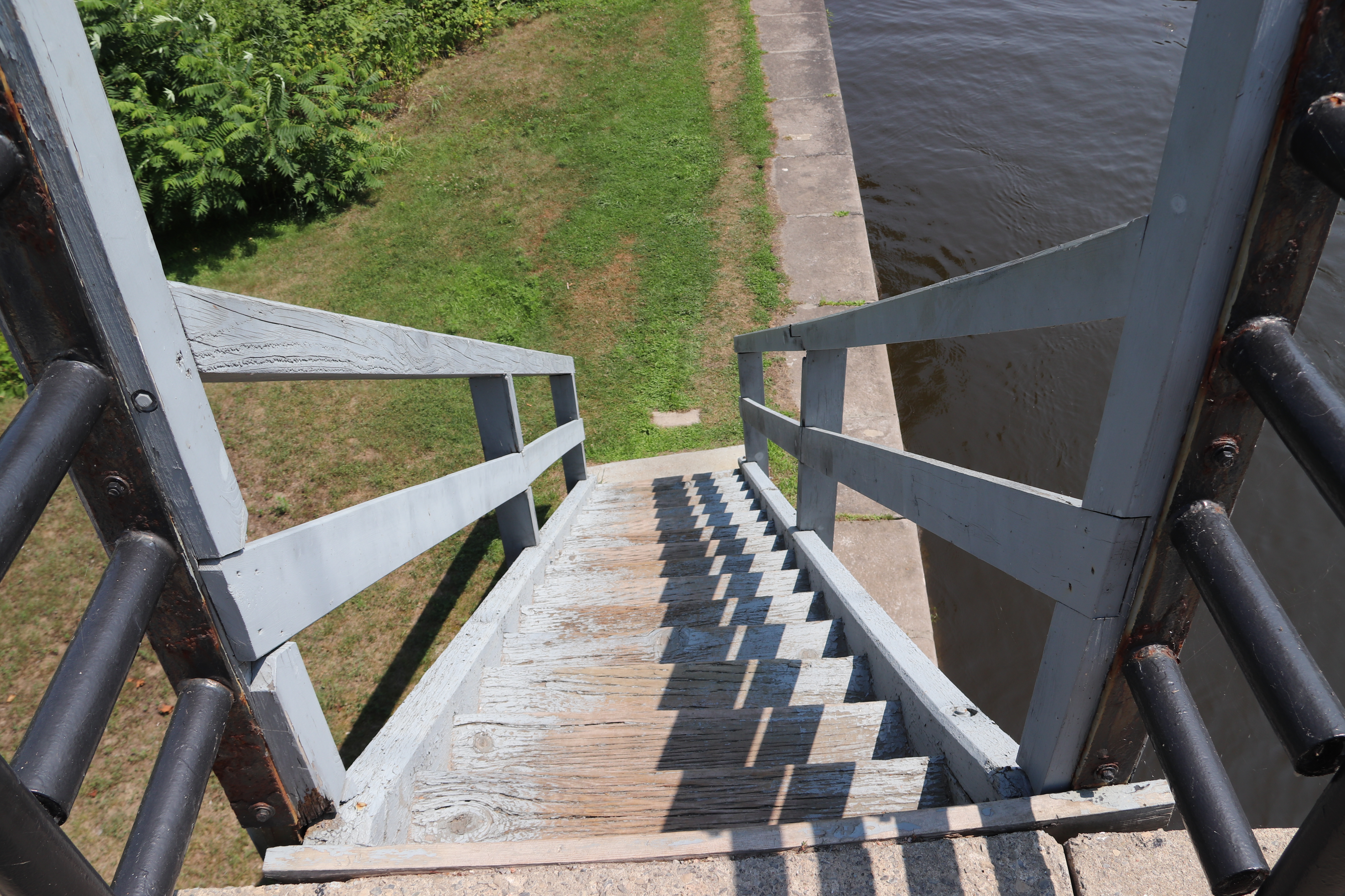
The arrangement of the locks here is unique along the waterway with a small basin set between each lock. These basins were built to allow the locks to follow a natural depression in the ground and therefore minimize the amount of excavation necessary. Before the work could begin, the land had to be cleared of its forest cover as was typical of most of the Rideau sites. Merickville, however, is one of the few villages on the waterway which had been settled before the construction of the canal. It had been established in 1794 when the American, William Merrick, came from Massachusetts to set up grist and lumber mills at the falls here. Throughout the 19th century, Merrickville continued to be an important industrial centre on the Rideau with grist, shingle and wool-carding mills. Some of the abandoned mill buildings still stand on the small island beside the locks. The products of the mills formed part of the cargoes carried on the waterway with vessels plying their way between the river settlements.
Between 1826 and 1832, an old Indian canoe route along the Rideau and Cataraqui Rivers was transformed at the command of the British government from untamed wilderness rivers into the Rideau Canal. The purpose of this remarkable artery was to provide the British army with a safe route for supplying its inland garrisons, avoiding the direct but exposed route along the St. Lawrence, which only the disorganization of the American forces had prevented from being cut during the War of 1812.
The 202 km (126 miles) of waterway was made navigable by 47 locks grouped in 24 stations with their associated dams and weirs. The word was designed and superintended by the Royal Engineers, commanded by Lieutenant Colonel John By; the actual construction was done by local contractors.
Despite the blockhouses along the waterway, the role of the Rideau has always been peaceful. It was a busy waterway, carrying settlers and supplies into the growing settlement of the interior intul the middle of the 19th century, when larger locks were opened on the St. Lawrence. At the same time, since the possibility of war between Britain and the United States was now unlikely, the British Board of Ordnance signed the system over to the colonial government of Canada in 1856. The period of the Canal's military administration was over.
Local commercial traffic remained important until the advent of the automobile and better roads about the time of World War 1. Since that time recreational boating has grown steadily so that now the system, well into its second century, is busier than ever.

MERRICKVILLE
La disposition des écluses ici est unique puisqu'elles sont séparées par de petits bassins. Ceux-ci on été creusés pour permettre aux écluses de suivre la dépression naturelle du terrain et pour limiter les travauz d'excavation. Avant de mettre les travaux en chantier, il a fallu débroussailler le terrain comme pour la plupart des écluses du Rideau d'ailleurs. Toutefois, Merrickville est l'un des rares villages en bordure du canal qui existant avant la construction du réseau. Il fut fondé en 1794 lorsque l'Américain William Merrick émigra du Massachusetts pour établir ici, près des chutes, des meuneries et des scieries. Tout au long du XIXe siècle, Merrickville coninua d'être un imporant centre industriel en bordure du Rideau avec ses meuneries, ses usines de bardeau et ses filatures de laine. Certain moulins abandonnés existent encore sur la petite île près des écluses. Les produits manufacturés étaient transportés par les navires qui faisaient la navette entre les petites localités.
Entre 1826 et 1832, une ancienne voie d'eau utilisée par les Indiens le long des rivières Rideau et Cataraqui fut transformée à la demande du gouvernement britannique en un réseau de voies navagables : le canal Rideau. Le but de cet ouvrage remarquable était de fournir à l'armée britannique une route sûre pour approvisionner ses garnisons. On évitait ainsi le Saint-Laurent, voie plus directe mais oussi plus dangereuse qui n'était demeurée ouverte qu'en raison de la désorganisation de l'armée américaine au cours de la guerre de 1812.
Le réseau de 202 km (126 milles) a été rendu navigable par la construction de 47 écluses regroupées en 24 postes. Les travaux ont été planifiés et surveillés par les Royal Engineers. Sous le commandement du lieutenant-colonel John By. Ils ont été exécutés par des entrepreneurs locaux.
Malgré les blockhaus qui se trouvent le long du réseau, le Rideau n'a jamais été troublé par la guerre. Ce fut un cours d'eau achalandé transportant colons et approvisionnement à l'intérieur des terres jusq'au milieu de XIXe siècle lorsque les grandes écluses du Saint-Laurent furent ouvertes à la navigation. Au même moment, la menace de guerre entre la Grande-Bretagne et les États-Unis s'étant estompée, le British Board of Ordnance céda le réseau au gouvernement colonial du Canada en 1856. Ceal mit fin à l'administration militaire du canal.
Le trafic commercial local demeura important jusqu'à l'apparition de l'automobile et la construction de meilleurs routes à l'époque de la Première Guerre mondiale. Depuis, les plaisanciers se sont faits de plus en plus nombreux, tant et si bien qu le réseau, qui en est à son deuxième siècle d'existence, et maintenant plus fréquenté que jamais.