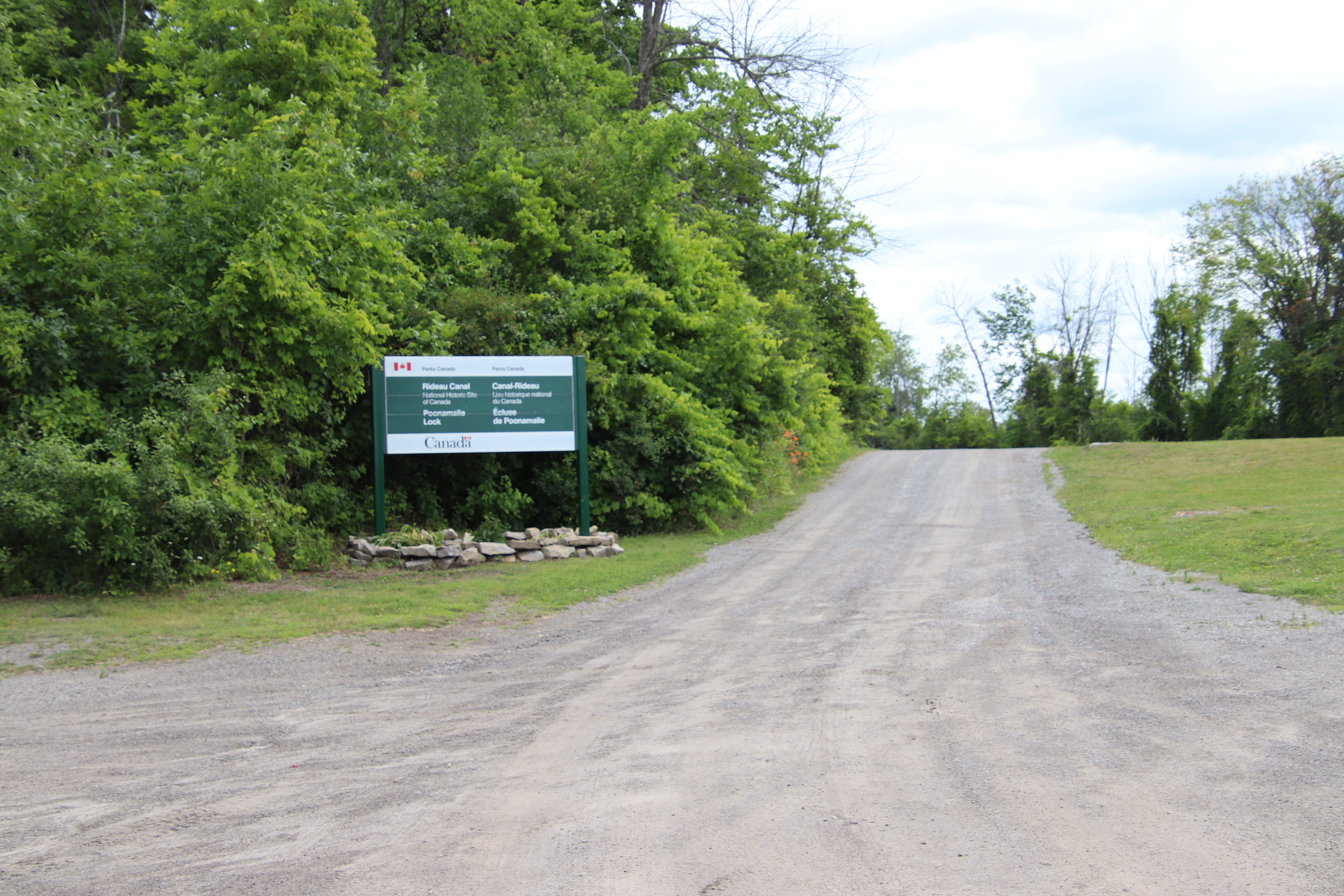
The Poonamalie Lockstation and its lock 32 occupy a location at about the middle of the 1.8 kilometre hand dug channel that runs south of the Rideau River. The lockstation can be accessed by land at the northwest end of Poonamalie Road which, in turn can be accessed on the west side of Lombard Street, southwest of Smiths Falls, Ontario.
Parks Canada
Rideau Canal
National Historic Site of Canada
Poonamalie Lock
Parcs Canada
Canal-Rideau
Lieus historique national du Canada
Écluse de Poonamalie


Proudly bringing you Canada at its best!
Parks Canada welcomes visitors from around the globe to one of the world's largest and most diverse park systems, featuring some of Canada's most important natural and cultural treasures. In this family of special places, there are national parks, national marine conservation areas, national historic sites and historic canals. At this time, twelve world heritage sites are designated in Canada, of which eight include in whole or in part, Parks Canada managed properties.
Canada's national historic canals vary from single locks to complex systems of interconnected locks, channels and natural waterways. The canals trace the routes of exploration, defence, commerce and transportation which helped shape Canada. Today they are extensive cultural and natural heritage corridors that preserve natural beauty and rich heritage and connect Canadians with their history.
Nine historic canals are maintained and operated by Parks Canada. Cape Breton Island's salt-water heart, Bras d'Or Lake, is reached through Nova Scotia's St. Peters Canal. Five canals in Québec bypass the shallows and rapids of historic lifelines of early Canada; the St. Lawrence, Ottawa and Richelieu rivers. Ontario's Trent-Severn Waterway and Rideau Canal weave passages through the province's interior lakes and rivers, and the Sault Ste. Marie Canal completed an all-Canadian Great Lakes navigation system.
When you visit Parks Canada national parks and national historic sites, you can be confident you will brigh home many wonderful memories of exciting and enriching experiences.
CANADA'S NATIONAL PARKS AND NATIONAL HISTORIC SITES

Tout ce que le Canada a de plus beau à offrir!
Parcs Canada souhaite la bienvenue aux visiteurs du monde entier à son réseau. l'un des plus vastes et des plus diversifiés de la planète, et les invite à admirer quelques-uns de ses plus imporatnts trésors naturels et culturels. Ce réseau compte des parcs nationaux, des aires marines nationales de conservation, des lieux historiques nationaux et des canaux historiques. En outre, douze des sites du patrimoine mondial sont situés au Canada et huit d'entre eux renferment en tout ou en partie des sites administrés par Parcs Canada.
Les canaux historiques de Parcs Canada sont diversifiés : écluses individuelles, réseaux complexes d'écluses interreliées, chenaux et voies d'eau naturelles. Les canaux sont les voies d'exporation, de défense, de négoce et de transport qui ont permis de façonner le Canada. Aujourd'hui, ce sont d'importants corridors naturels et culturels qui préservent la beauté de la nature de même qu'un riche patrimoine et qui rattachent les Canadiens à leur histoire.
Parcs Canada entretient et exploite neuf canaux historiques. Le canal de St. Peters en Nouvelle-Écosse consuit au Bras d'Or, étendue d'eau salée au cœur de L'île du Cap-Breton. Au Québec, cinq canaux permettent de contourner les eaux peu profondes et les rapides des cours d'eau qui ont marqué les débuts de notre pays, à savoir : le fleuve Saint-Laurent, la rivière des Outaouais et la rivière Richelieu. La voie navigable Trent-Severn et le canal Rideau en Ontario donnent accès aux lacs et aux rivières de l'interieur de la province. Quant au canal de Sault Ste. Marie, il a été le point final du réseau de navigation canadien des Grands Lacs.
Soyez assuré qu'une visite aux parcs nationaux et aux lieux historiques nantionaux de Parcs Canada sera riche en souvenirs et en expériences passionnantes et stimulantes.
LES PARCS NATIONAUX ET LES HISTORIQUES NATIONAUX DU CANADA


POONAMALIE
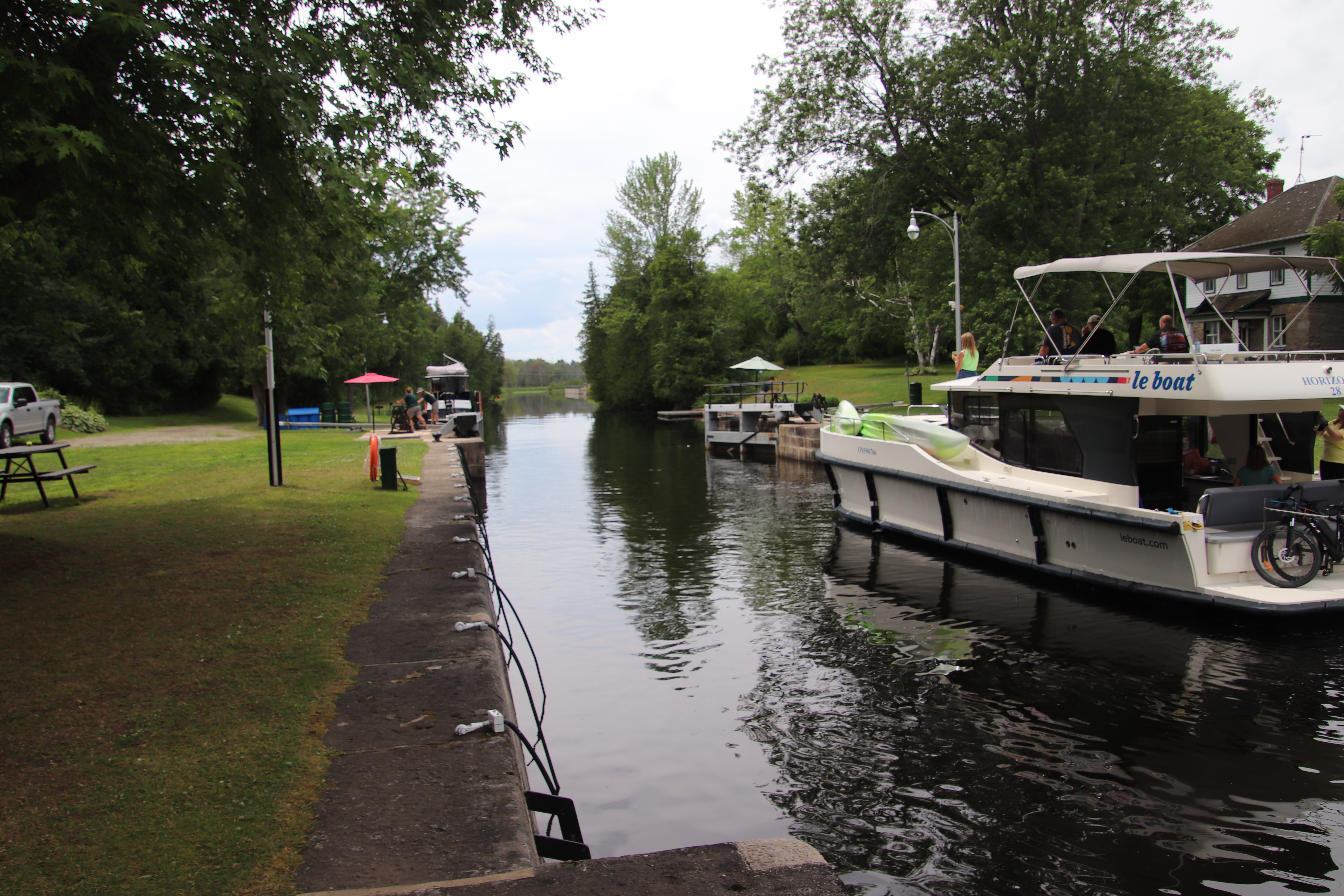
At this lock, Colonel John By opted to bypass a particularly shallow and sinuous section of the Rideau River with a canal cut. Originally proposed to be excavated on the north side of the river, the canal cut was moved to the south side after the discovery of hard rock which would have made the excavation very difficult.
A weir (water control dam) was built across the mouth of the Rideau River at the outlet of Rideau Lake (now Lower Rideau Lake). This allowed the water of Rideau Lake to be raised, providing required navigation depth in the canal cut. The weir also served to control the spring flooding, allowing the level of Rideau Lake to be dropped in winter and act as a catchment area for spring runoff. However, its position on the Rideau Lake made it susceptible to ice damage. In April 1904, a sheet of ice 300 feet (91 m) long and 70 feet (21 m) wide struck the weir, opening up a breach 75 feet (23 m) wide. The failure of the weir threatened to flood all of Smiths Falls. By the fall of 1904 a new concrete weir had replaced the old wooden structure.
The unusual name Poonamalie comes from the Tamal (India) word meaning cat hill or cat mountain. It is assumed that this area reminded one of the Royal Engineers of a pervious posting in western India where the word Poonamalie was used.
Between 1826 and 1832, an old Indian canoe route along the Rideau and Cataraqui Rivers was transformed at the command of the British government from untamed wilderness rivers into the Rideau Canal. The purpose of this remarkable artery was to provide the British army with a safe route for supplying its inland garrisons, avoiding the direct but exposed route along the St. Lawrence, which only the disorganization of the American forces had prevented from being cut during the War of 1812.
The 202 km (126 miles) of waterway was made navigable by 47 locks grouped in 24 stations with their associated dams and weirs. The word was designed and superintended by the Royal Engineers, commanded by Lieutenant Colonel John By; the actual construction was done by local contractors.
Despite the blockhouses along the waterway, the role of the Rideau has always been peaceful. It was a busy waterway, carrying settlers and supplies into the growing settlement of the interior until the middle of the 19th century, when larger locks were opened on the St. Lawrence. At the same time, since the possibility of war between Britain and the United States was now unlikely, the British Board of Ordnance signed the system over to the colonial government of Canada in 1856. The period of the Canal's military administration was over.
Local commercial traffic remained important until the advent of the automobile and better roads about the time of World War 1. Since that time recreational boating has grown steadily so that now the system, well into its second century, is busier than ever.

POONAMALIE
À cette écluse, le colonel By opta pour la derivation et fit creuser une tranchée pour éviter un tronçon particulièrement peu profonde et sineux de la Rideau. Initialement, la tranchée devait être pratiquée sur la rive nord de la rivière, mais elle fut déplacée sur la rive sud, après la découverte de roche dure qui aurait endu l’excavation très difficile.
Au point d’emergence de la Rideau (lac Lower Rideau), on bâtit un déversoir (barrage de contrôle du debit) pour enjamber l’embouchure de la Rideau. On put ainsi élever le niveau du lac Rideau et creuser une tranchée suffisamment profonde pour la navigation. Ce déversoir servit aussi à controller la crue printanière, puisque le lac don’t le niveau était abaissé en hiver servait au captage des eaux de fonte. Vu son emplacement au pied du lac Rideau, il risquait d’être endommagé par la glace. Ena vril 1904, une nappe de glace de 300 pieds (91 m) de long et 70 pieds (21 m) de large heurta le déversoir, Smiths Falls faillit être inondé. A l’automne de 1904, un nouveau déversoir en béton remplaça la vieille structure en bois.
Le nom inhabituel de cett écluse, Poonamalie, vient des Tamouls, un people des Indes, et signifie colline du chat. On presume que cette region rappelait à un des members des Royal Engineers une affectation antérieure aux Indes occidentales.
Entre 1826 et 1832, une ancienne voie d'eau utilisée par les Indiens le long des rivières Rideau et Cataraqui fut transformée à la demande du gouvernement britannique en un réseau de voies navagables : le canal Rideau. Le but de cet ouvrage remarquable était de fournir à l'armée britannique une route sûre pour approvisionner ses garnisons. On évitait ainsi le Saint-Laurent, voie plus directe mais oussi plus dangereuse qui n'était demeurée ouverte qu'en raison de la désorganisation de l'armée américaine au cours de la guerre de 1812.
Le réseau de 202 km (126 milles) a été rendu navigable par la construction de 47 écluses regroupées en 24 postes. Les travaux ont été planifiés et surveillés par les Royal Engineers. Sous le commandement du lieutenant-colonel John By. Ils ont été exécutés par des entrepreneurs locaux.
Malgré les blockhaus qui se trouvent le long du réseau, le Rideau n'a jamais été troublé par la guerre. Ce fut un cours d'eau achalandé transportant colons et approvisionnement à l'intérieur des terres jusq'au milieu de XIXe siècle lorsque les grandes écluses du Saint-Laurent furent ouvertes à la navigation. Au même moment, la menace de guerre entre la Grande-Bretagne et les États-Unis s'étant estompée, le British Board of Ordnance céda le réseau au gouvernement colonial du Canada en 1856. Ceal mit fin à l'administration militaire du canal.
Le trafic commercial local demeura important jusqu'à l'apparition de l'automobile et la construction de meilleurs routes à l'époque de la Première Guerre mondiale. Depuis, les plaisanciers se sont faits de plus en plus nombreux, tant et si bien qu le réseau, qui en est à son deuxième siècle d'existence, et maintenant plus fréquenté que jamais.


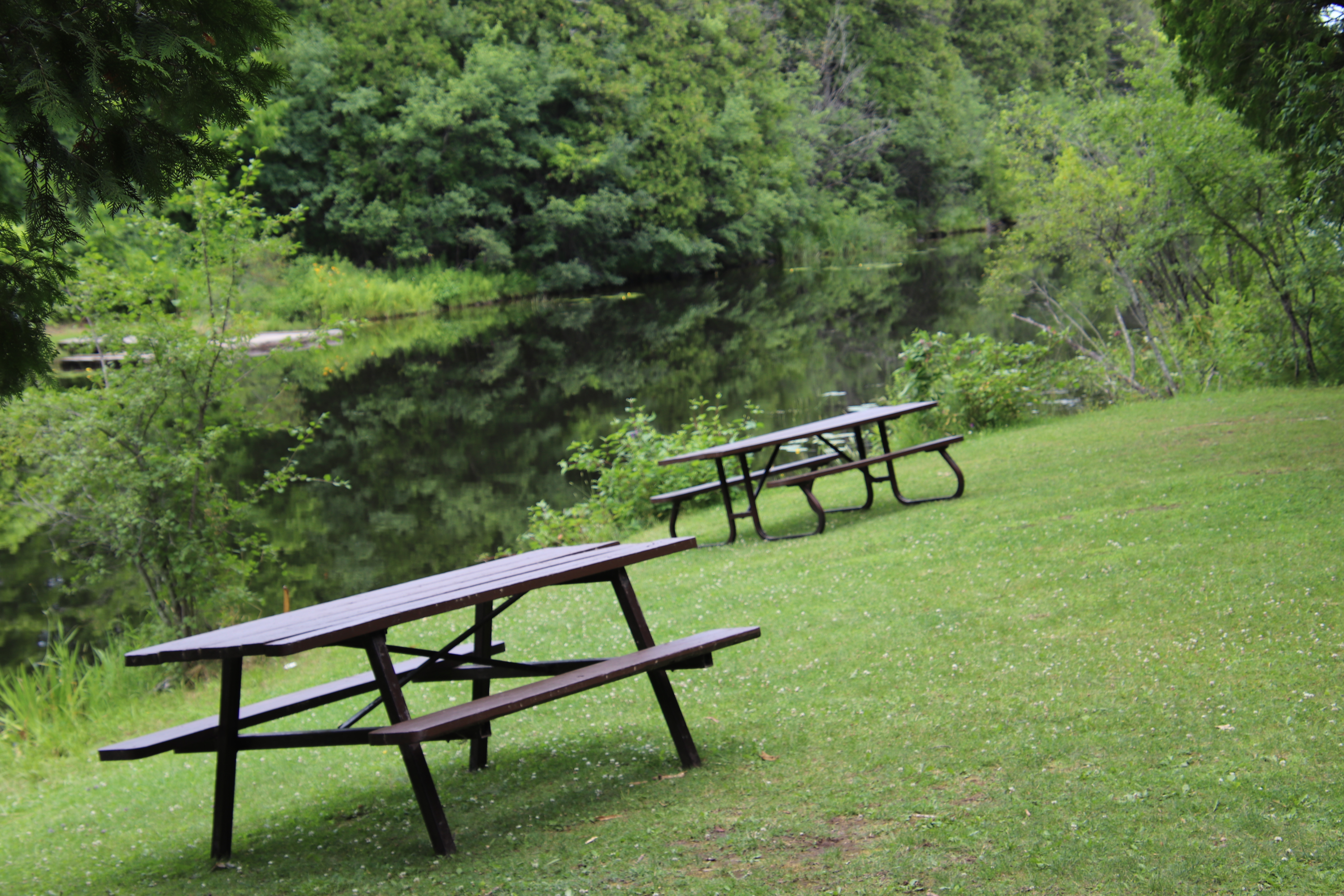
From this point on we leave the location for the lock and follow the roadway through the trees onto a stone road to the Poonamalie Dam and then return.
These wooden structures that look like inverted sieves occupied random places in the lockstation. They are turtle next protectors.
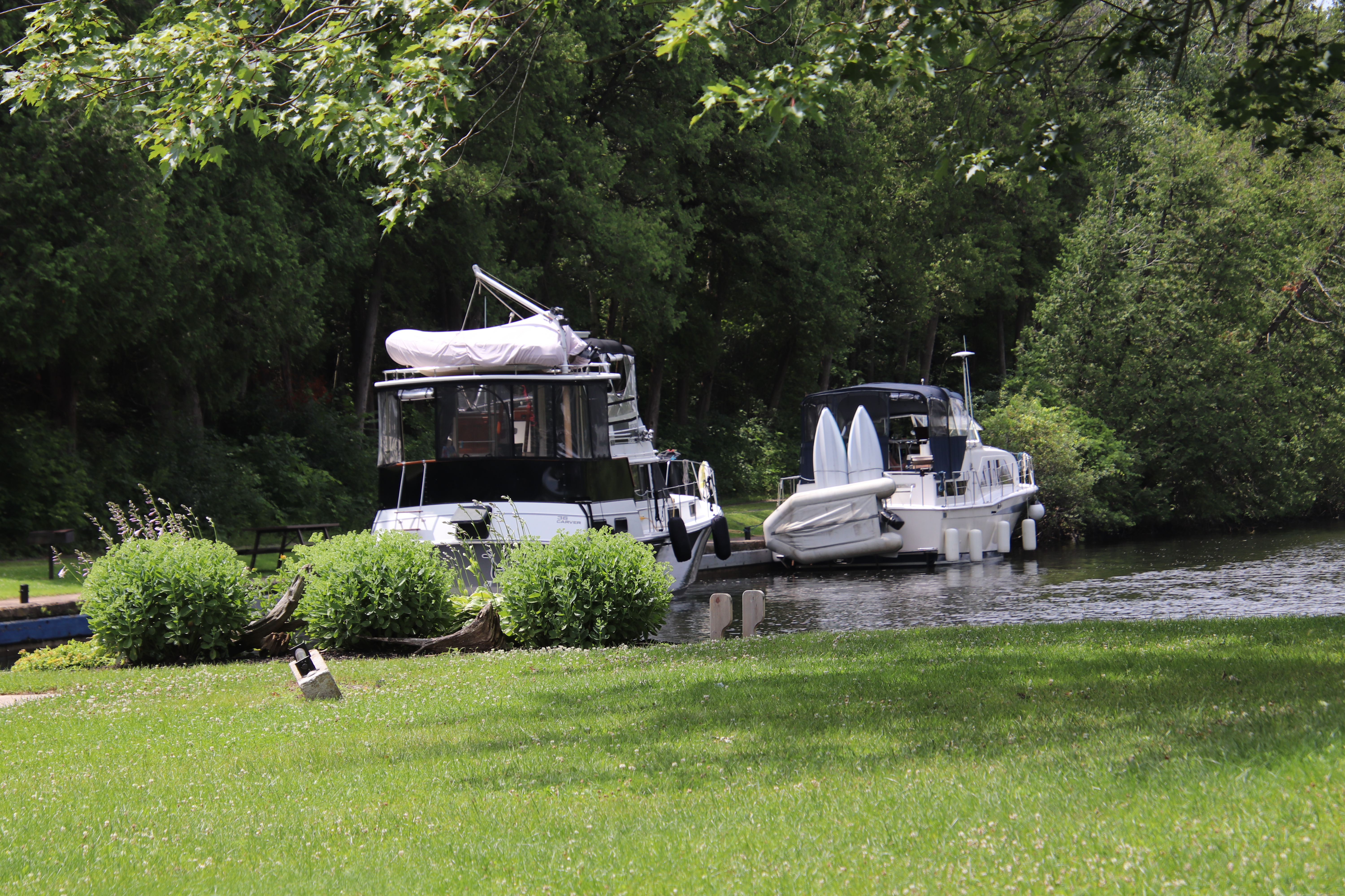
The Poonamalie channel looks upstream at Garvins Bay. What looks like land behind the moored boats is acutally heavy growth of water weeds, most likely lilly pads. The green channel markers have a flat top. The red ones have a pointed top. In poor light they can still be identified.