The Black Rapids lockstation in the Rideau Canal system occupies the
west bank of the Rideau River east of Prince of Wales Drive. It's
access road is the first left turn south of Amberwood Crescent.
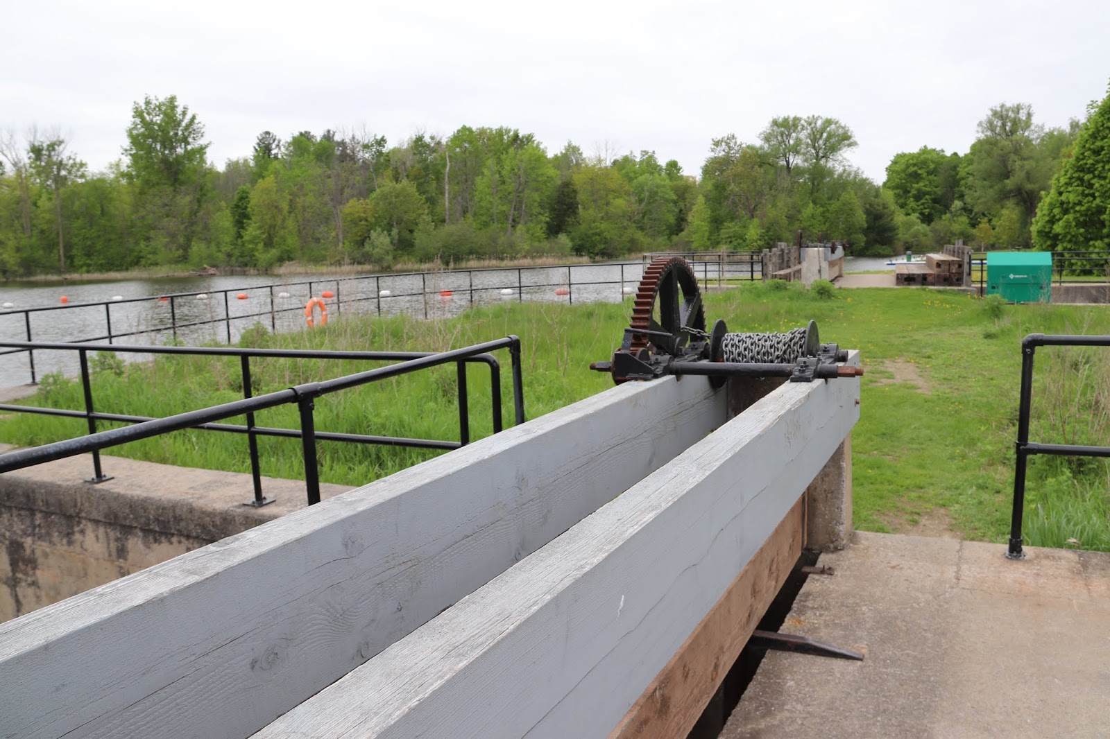
The picture above looks upstream at the lower gate of lock 13, the single lock at the Black Rapids lockstation.
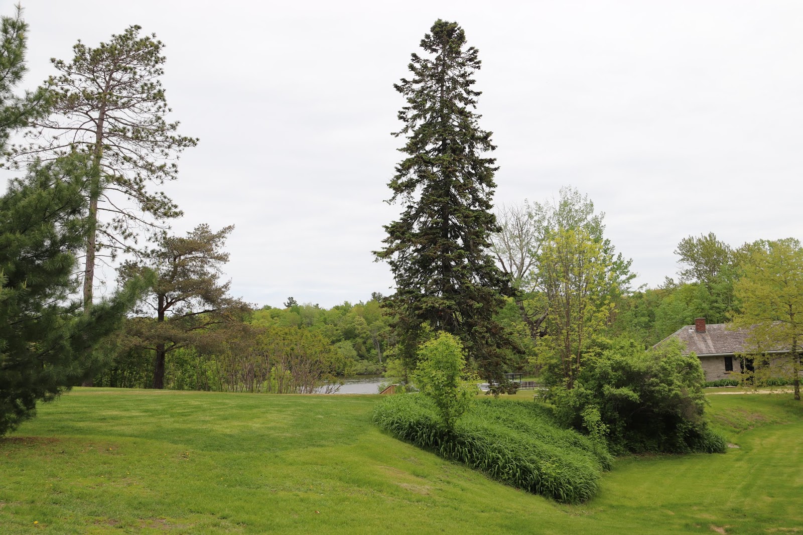
The
buildings surrounded by the white fence are part of the lock station.
They probably were originally the lockmaster's house. They are not open
to the public or accessible to the public.
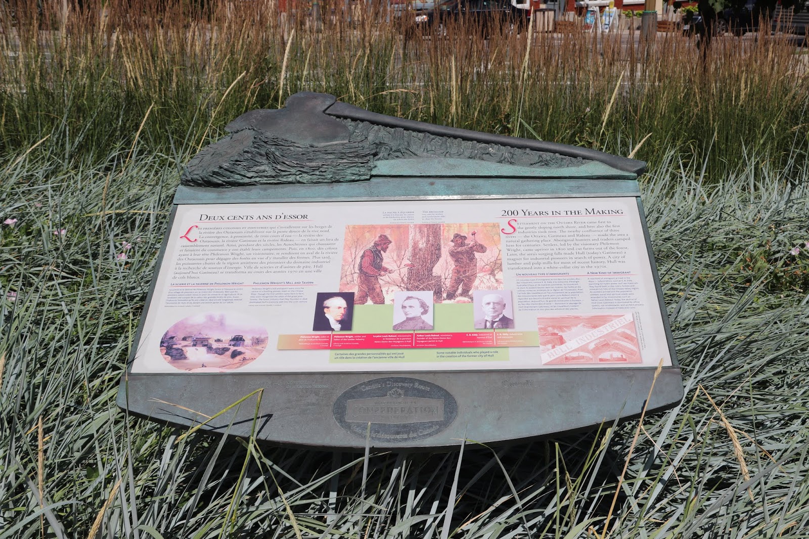
The
metal device decorating the garden is called a crab. They're used to
control the sluices and gates on the locks. The Black Rapids lockstation uses a powered system to do those jobs now, relegating this crab
to decorating this garden.
 |
This path goes to a foot bridge over Black Rapids Creek.
|
 |
| The lockmaster's office building |
 |
These pink trilliums have a home
in the lockmaster's office garden. |
BLACK RAPIDS
The peace and tranquility of this lock belies the fact that Colonel John By required design changes at this and many other locks to accommodate the fury of spring flooding on the Rideau.
In order to control the water level and raise it tot he required navigation depth, Colonel By had propose a 10 foot (3.0 m) high overflow dam. The first rush of spring floodwater over this structure quickly convince By that the dam would be undermined by the power of water eroding the bedrock on which the dam sat. So, he raised the overflow dam by 2 feet and added a waste weir (a water control dam) between the overflow dam and the lock. This weir allowed most of the spring flood waters to pass through it rather than over the dam. The use of a waste weir was so successful that By adopted it at most of the other locks.
Between 1826 and 1832, an old Indian canoe route along the Rideau and Cataraqui Rivers was transformed at the command of the British government from untamed wilderness rivers into the Rideau Canal. The purpose of this remarkable artery was to provide the British army with a safe route for supplying its inland garrisons, avoiding the direct but exposed route along the St. Lawrence, which only the disorganization of the American forces had prevented from being cut during the War of 1812.
The 202 km (126 miles) of waterway was made navigable by 47 locks grouped in 24 stations with their associated dams and weirs. The word was designed and superintended by the Royal Engineers, commanded by Lieutenant Colonel John By; the actual construction was done by local contractors.
Despite the blockhouses along the waterway, the role of the Rideau has always been peaceful. It was a busy waterway, carrying settlers and supplies into the growing settlement of the interior until the middle of the 19th century, when larger locks were opened on the St. Lawrence. At the same time, since the possibility of war between Britain and the United States was now unlikely, the British Board of Ordnance signed the system over to the colonial government of Canada in 1856. The period of the Canal's military administration was over.
Local commercial traffic remained important until the advent of the automobile and better roads about the time of World War 1. Since that time recreational boating has grown steadily so that now the system, well into its second century, is busier than ever.
BLACK RAPIDS
Le calme et la sérénité de cette écluse sont tromperus. En effet, au moment de la construction, le colonel By exigea que le plan de cette écluse et de nombreuses autres soit modifié pour contenir les eaux tumulteuses des crues printanières.
Afin de contrlôler le début d'eau d'obtenir la profondeur nécessaire à la navigation, le colonel By proposa un barrage-déversoir de 10 pieds (3 m). Dès les premiers jaillissement de l'eau de fonte, By remarqua que la force de l'eau érodait la roche-mère sur laquelle reposait le barrage-déversoir. Il décida donc d'élever ce dernier de deux pieds et d'ajouter un déversoir s'implissiat de l'eau de crue qui n'inondait plus le barrage. Contant l'efficacité de ce déversoir, By l'adopta pour la plupart des autres écluses.
Entre 1826 et 1832, une ancienne voie d'eau utilisée par les Indiens le long des rivières Rideau et Cataraqui fut transformée à la demande du gouvernement britannique en un réseau de voies navagables : le canal Rideau. Le but de cet ouvrage remarquable était de fournir à l'armée britannique une route sûre pour approvisionner ses garnisons. On évitait ainsi le Saint-Laurent, voie plus directe mais oussi plus dangereuse qui n'était demeurée ouverte qu'en raison de la désorganisation de l'armée américaine au cours de la guerre de 1812.
Le réseau de 202 km (126 milles) a été rendu navigable par la construction de 47 écluses regroupées en 24 postes. Les travaux ont été planifiés et surveillés par les Royal Engineers. Sous le commandement du lieutenant-colonel John By. Ils ont été exécutés par des entrepreneurs locaux.
Malgré les blockhaus qui se trouvent le long du réseau, le Rideau n'a jamais été troublé par la guerre. Ce fut un cours d'eau achalandé transportant colons et approvisionnement à l'intérieur des terres jusq'au milieu de XIXe siècle lorsque les grandes écluses du Saint-Laurent furent ouvertes à la navigation. Au même moment, la menace de guerre entre la Grande-Bretagne et les États-Unis s'étant estompée, le British Board of Ordnance céda le réseau au gouvernement colonial du Canada en 1856. Ceal mit fin à l'administration militaire du canal.
Le trafic commercial local demeura important jusqu'à l'apparition de l'automobile et la construction de meilleurs routes à l'époque de la Première Guerre mondiale. Depuis, les plaisanciers se sont faits de plus en plus nombreux, tant et si bien qu le réseau, qui en est à son deuxième siècle d'existence, et maintenant plus fréquenté que jamais.
The Black Rapids lock gates have and elector mechanical control system. The mechanical crabs, devices for manual control, are used as a symbol for the canal system, which is why there are some in place for this lock.