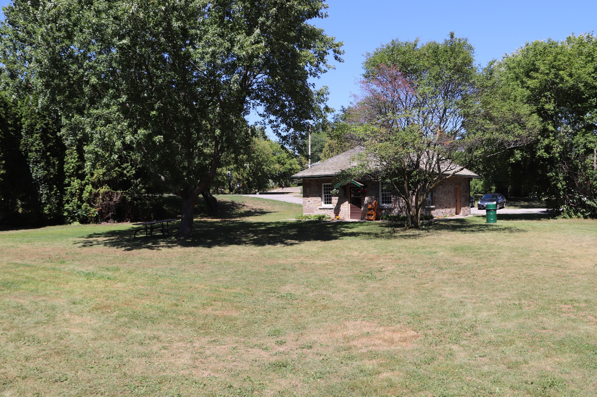
Old Slys Lockstation occupies a Rideau Canal channel close to the southeast corner of Queen Street and Odl Slys Road in Smiths Falls Ontario.
Parks Canada
Rideau Canal
National Historical Site of Canada
Old Slys Locks
Parcs Canada
Canal-Rideau
Lieu historique national du Canada
Écluses d'Old Slys
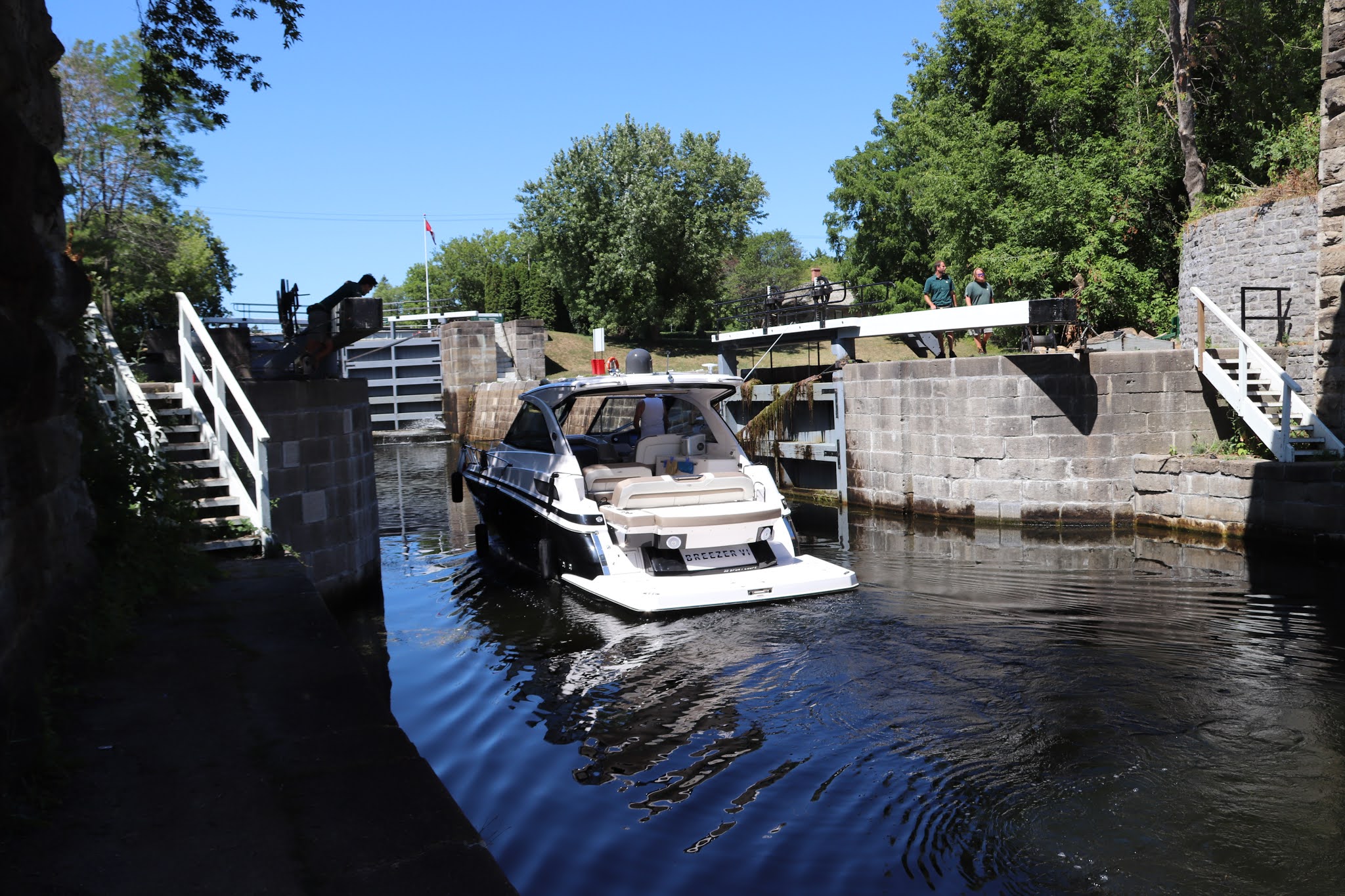
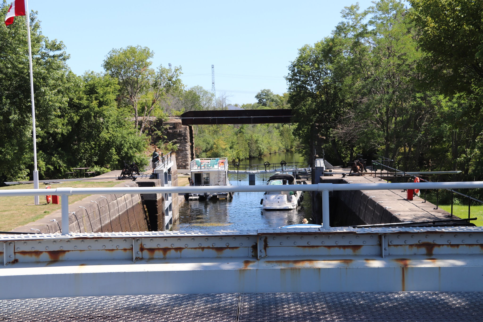
My personal impression of the Old Slys Lockstation is that of all the lockstations from Ottawa to Smiths Falls its locks occupy the most cramped space. Though not the highest lift, at 1.9 metres (16 ft.), in the system, the cramped space make it appear to be very steep.
OLD SLYS
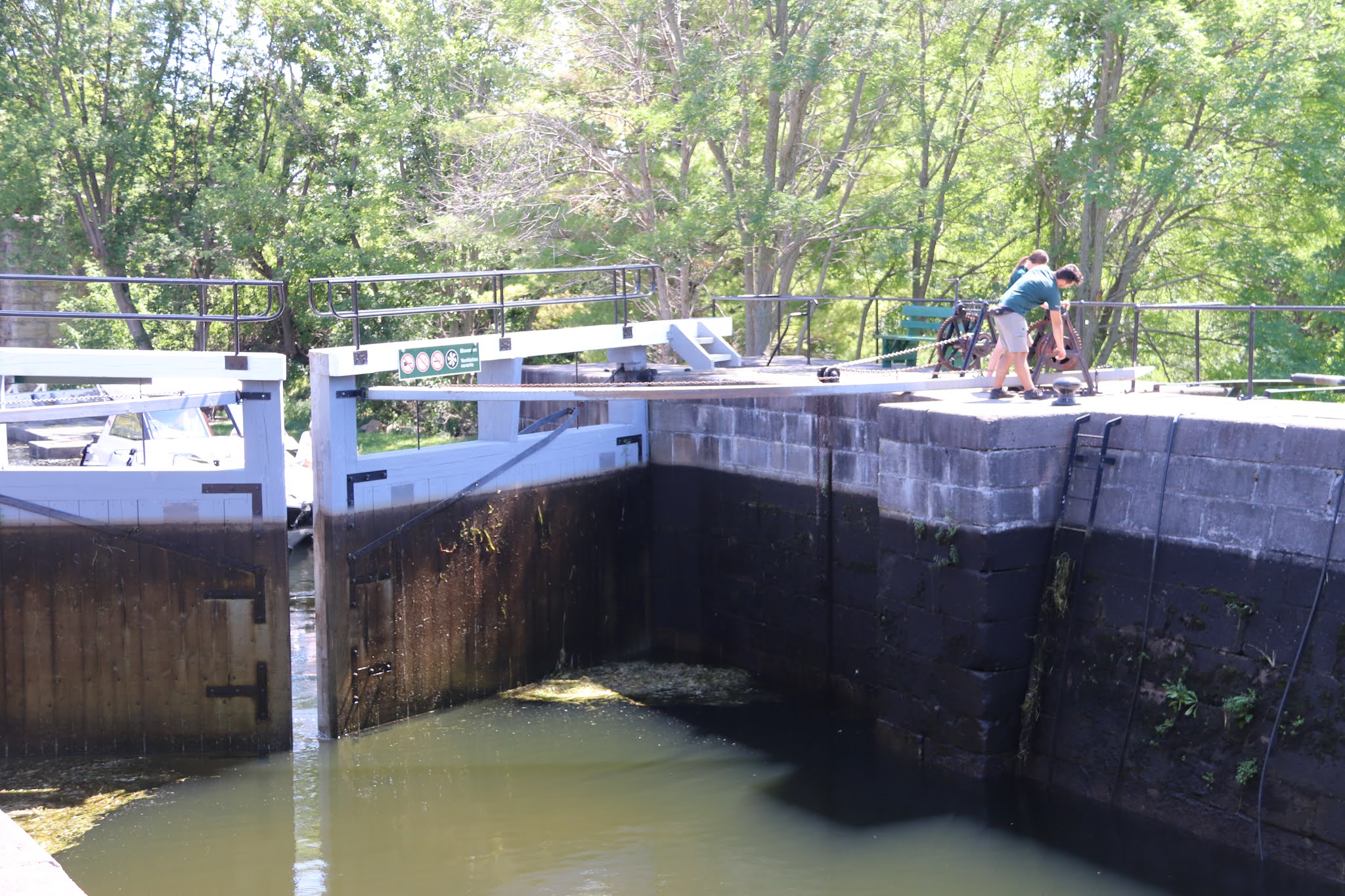
This lockstation was named after William Sly who settled here in 1798. A set of rapids fell almost 16 feet (5 m) over a distance of 720 yards (660m). It was originally proposed to have the lower lock angled back into the river channel but in 1828, at By's urging, the size of the locks were increased from 108 feet (33m) to 134 feet (41 m) to accommodate steamboats. These larger steamboats would not have been able to make the angled turn, so the locks were set parallel to the shoreline and a canal cut extended below the lower lock to provide a straight entry into the lock.
Many changes have taken place over the years, not the least of which is the almost complete burial of the 21 foot (6.4 m) high stone dam which blocked the original channel of the Rideau River. The area behind the dam has been filled in over the years and now only the top few feet (1 m) remain visible.
Between 1826 and 1832, an old Indian canoe route along the Rideau and Cataraqui Rivers was transformed at the command of the British government from untamed wilderness rivers into the Rideau Canal. The purpose of this remarkable artery was to provide the British army with a safe route for supplying its inland garrisons, avoiding the direct but exposed route along the St. Lawrence, which only the disorganization of the American forces had prevented from being cut during the War of 1812.
The 202 km (126 miles) of waterway was made navigable by 47 locks grouped in 24 stations with their associated dams and weirs. The word was designed and superintended by the Royal Engineers, commanded by Lieutenant Colonel John By; the actual construction was done by local contractors.
Despite the blockhouses along the waterway, the role of the Rideau has always been peaceful. It was a busy waterway, carrying settlers and supplies into the growing settlement of the interior until the middle of the 19th century, when larger locks were opened on the St. Lawrence. At the same time, since the possibility of war between Britain and the United States was now unlikely, the British Board of Ordnance signed the system over to the colonial government of Canada in 1856. The period of the Canal's military administration was over.
Local commercial traffic remained important until the advent of the automobile and better roads about the time of World War 1. Since that time recreational boating has grown steadily so that now the system, well into its second century, is busier than ever.

OLD SLYS
Cette écluse porte le nom de William Sly qui s'établit ici en 1798. Les rapides chutent de 16 pieds (5 m) sur 720 pieds (660 m). Au départ, l'écluses en aval devait être à angle par rapport au chenal naturel, mais en 1828, à la demande de By, on porta les dimensions de l'écluse de 108 pieds (33 m) à 134 pieds (41 m). Les vapeurs plus larges n'auraient pas pu effectuer le virage à angle et c'est pourquoi les écluses furent aménagées parallèlement au rivage tandis que la tranchée était prolongée au-delà de l'écluse en aval pour fournir un accès en ligne droite.
Beaucoup de changements furent apportés au fil des ans, notamment l'enfouissement presque complet du barrage en pierres de 21 pied (6,4 m) qui bloquait le chenal naturel de la Rideau. Le secteur situé derrière le barrage fut remblayé au cours des ans et maintenant queques pieds (1 m) demeurent visibles.
Entre 1826 et 1832, une ancienne voie d'eau utilisée par les Indiens le long des rivières Rideau et Cataraqui fut transformée à la demande du gouvernement britannique en un réseau de voies navagables : le canal Rideau. Le but de cet ouvrage remarquable était de fournir à l'armée britannique une route sûre pour approvisionner ses garnisons. On évitait ainsi le Saint-Laurent, voie plus directe mais oussi plus dangereuse qui n'était demeurée ouverte qu'en raison de la désorganisation de l'armée américaine au cours de la guerre de 1812.
Le réseau de 202 km (126 milles) a été rendu navigable par la construction de 47 écluses regroupées en 24 postes. Les travaux ont été planifiés et surveillés par les Royal Engineers. Sous le commandement du lieutenant-colonel John By. Ils ont été exécutés par des entrepreneurs locaux.
Malgré les blockhaus qui se trouvent le long du réseau, le Rideau n'a jamais été troublé par la guerre. Ce fut un cours d'eau achalandé transportant colons et approvisionnement à l'intérieur des terres jusq'au milieu de XIXe siècle lorsque les grandes écluses du Saint-Laurent furent ouvertes à la navigation. Au même moment, la menace de guerre entre la Grande-Bretagne et les États-Unis s'étant estompée, le British Board of Ordnance céda le réseau au gouvernement colonial du Canada en 1856. Ceal mit fin à l'administration militaire du canal.
Le trafic commercial local demeura important jusqu'à l'apparition de l'automobile et la construction de meilleurs routes à l'époque de la Première Guerre mondiale. Depuis, les plaisanciers se sont faits de plus en plus nombreux, tant et si bien qu le réseau, qui en est à son deuxième siècle d'existence, et maintenant plus fréquenté que jamais.


Old Sly's Rapids
Though associated more with Smiths Falls today, Old Sly's began with a history all its own. The first settler to the site was William Sly (known as Old Sly), who arrived with his family in 1798 and for whom the rapids were named. The property was later picked up by the ordnance Department for the construction of the Old Sly's Locks, completed in 1831. In 1852, Joshua Bates built a grist and textile mill on the rapids, adjacent to his family home which is not the Heritage House Museum. Later in 1893, the rapids also became home to the Smiths Falls Electric Power company, a hydroelectric generating station.

Rapides Old Sly
Bien qu'il soit davantage à Smiths Falls aujourd'hui, Old Slys a commencé par une histoire qui lui est propre. William Sly (connu sous le nom de Old Sly), fut le premier colon à s'installer sur les lieux en 1798 avec sa famille et pour qui les rapides furent nommés. La propriété fut ensuite récupérée par le département des ordonnances pour la construction des écluses de Old Sly, achevée en 1831. En 1852, Joshua Bates a construit un molin à farine et une usine de textile dans les rapides, a proximité de la maison familiale, devenue le Heritage House Museum. Plus tard en 1893, les rapides ont également arbitré la Smiths Falls Electric Power Company, une centrale hydroélectrique.
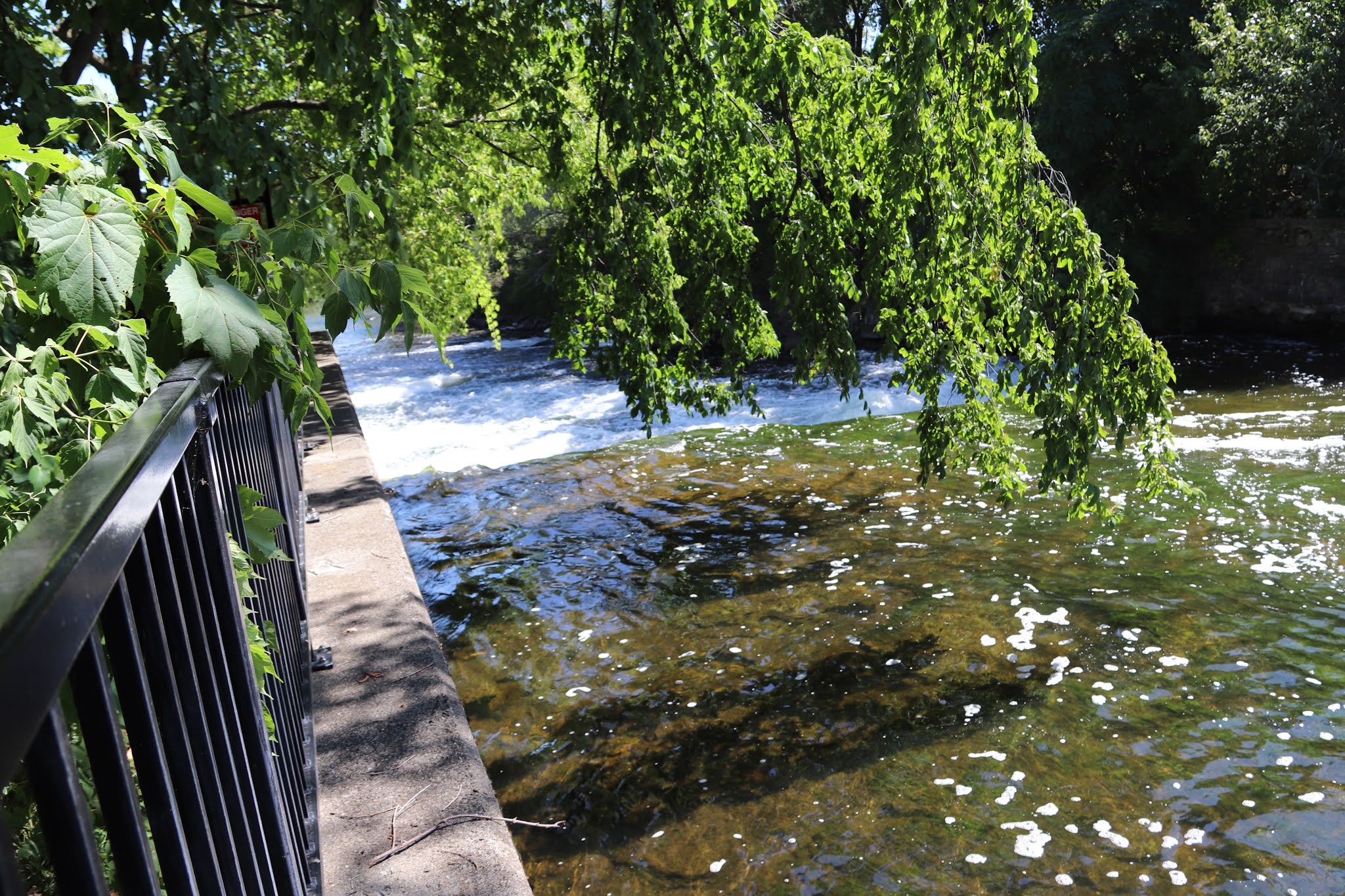
This shows the downstream side of the waste water weir, a small dam that can allow water from the spring thaw run freely and thereby protecting the lock. After the thaw and before the lockstation opens after the 24th of May weekend the weir is raised by adding a stack of squared logs.
The following views show the upstream side of the waste water weir. a line of floats warns swimmers and boaters to keep away. It may look peaceful on this side of the weir but it has a very strong and dangerous undertow.


