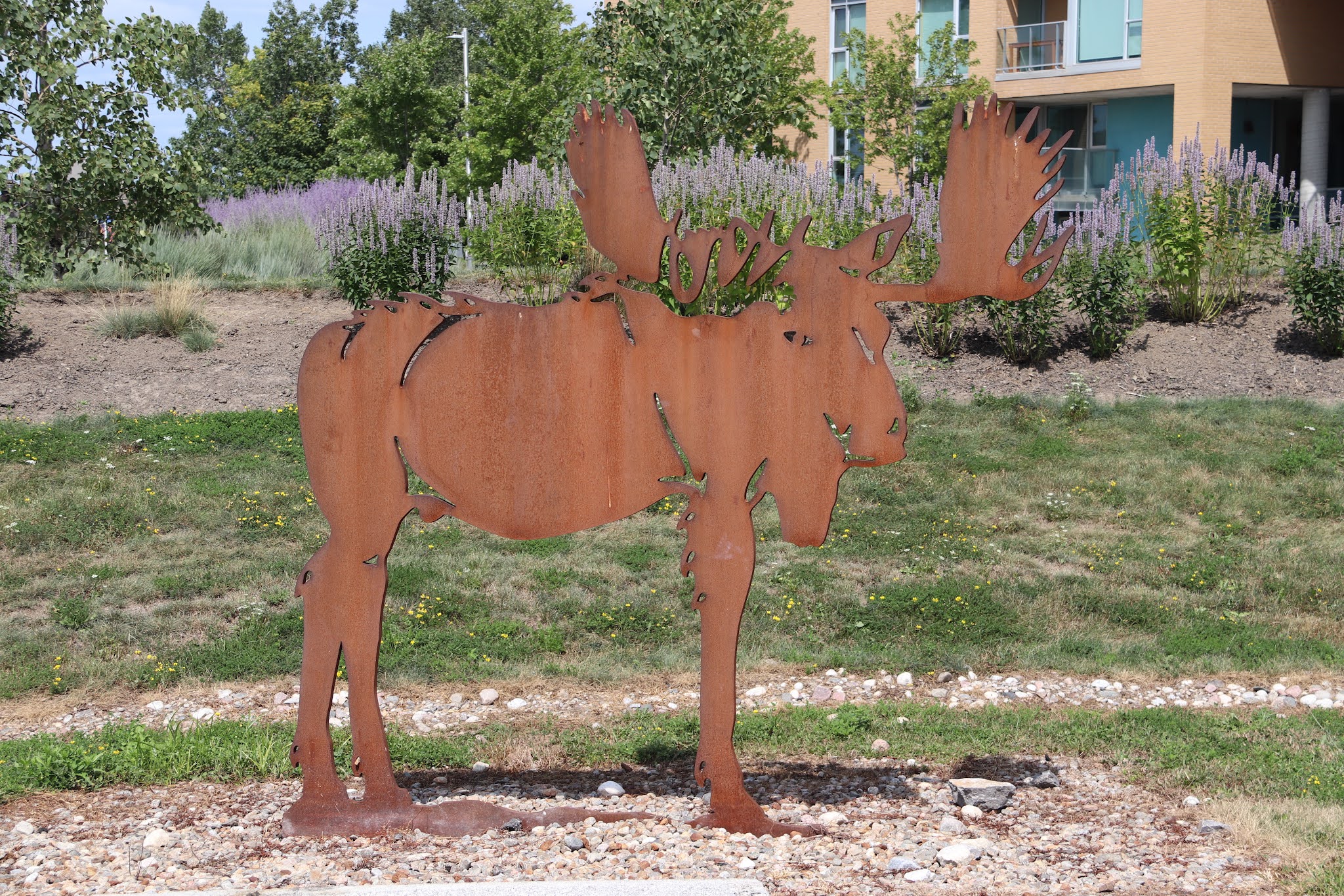
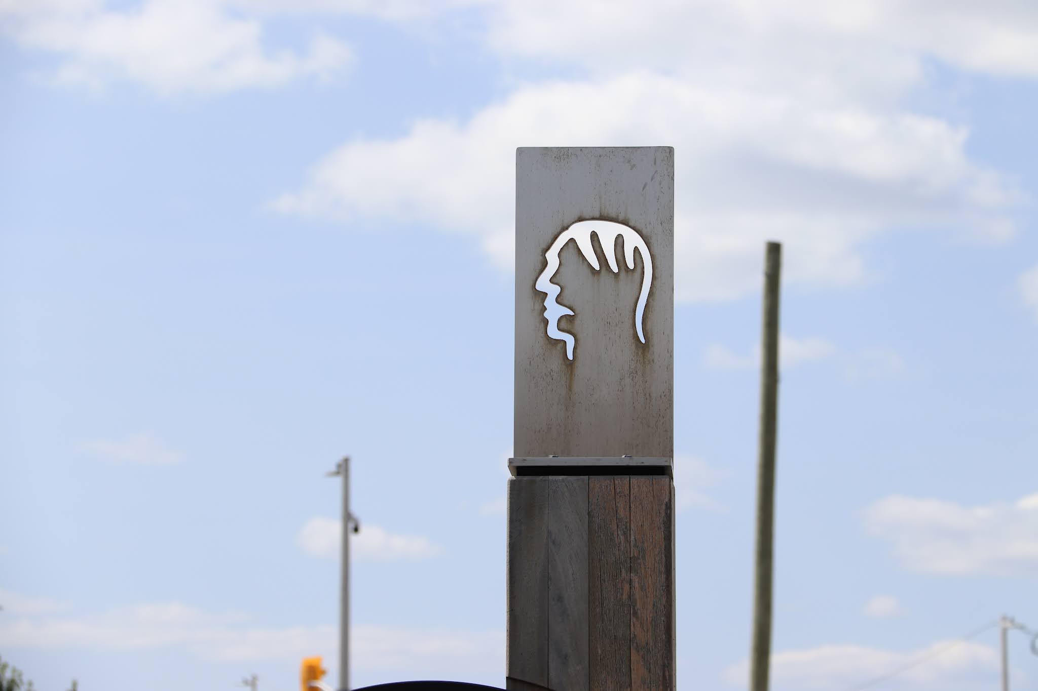
The tree in memory of Deirdre McQuillan stands in Brewer Park northeast of the baseball diamonds, on the north side of the pathway.


IN LOVING MEMORY OF
DEIRDRE
McQUILLAN
Cuimhnigh i gconai
(Always remember)


The tree in memory of Deirdre McQuillan stands in Brewer Park northeast of the baseball diamonds, on the north side of the pathway.
IN LOVING MEMORY OF
DEIRDRE
McQUILLAN
Cuimhnigh i gconai
(Always remember)


The bench memorializing Ann Lyon occupies the east side of Brewer Park, south of the corner of Seneca Street and Cameron Avenue.


Ann Lyon
1896-1995
She loved us all
Elle nous aimait tous


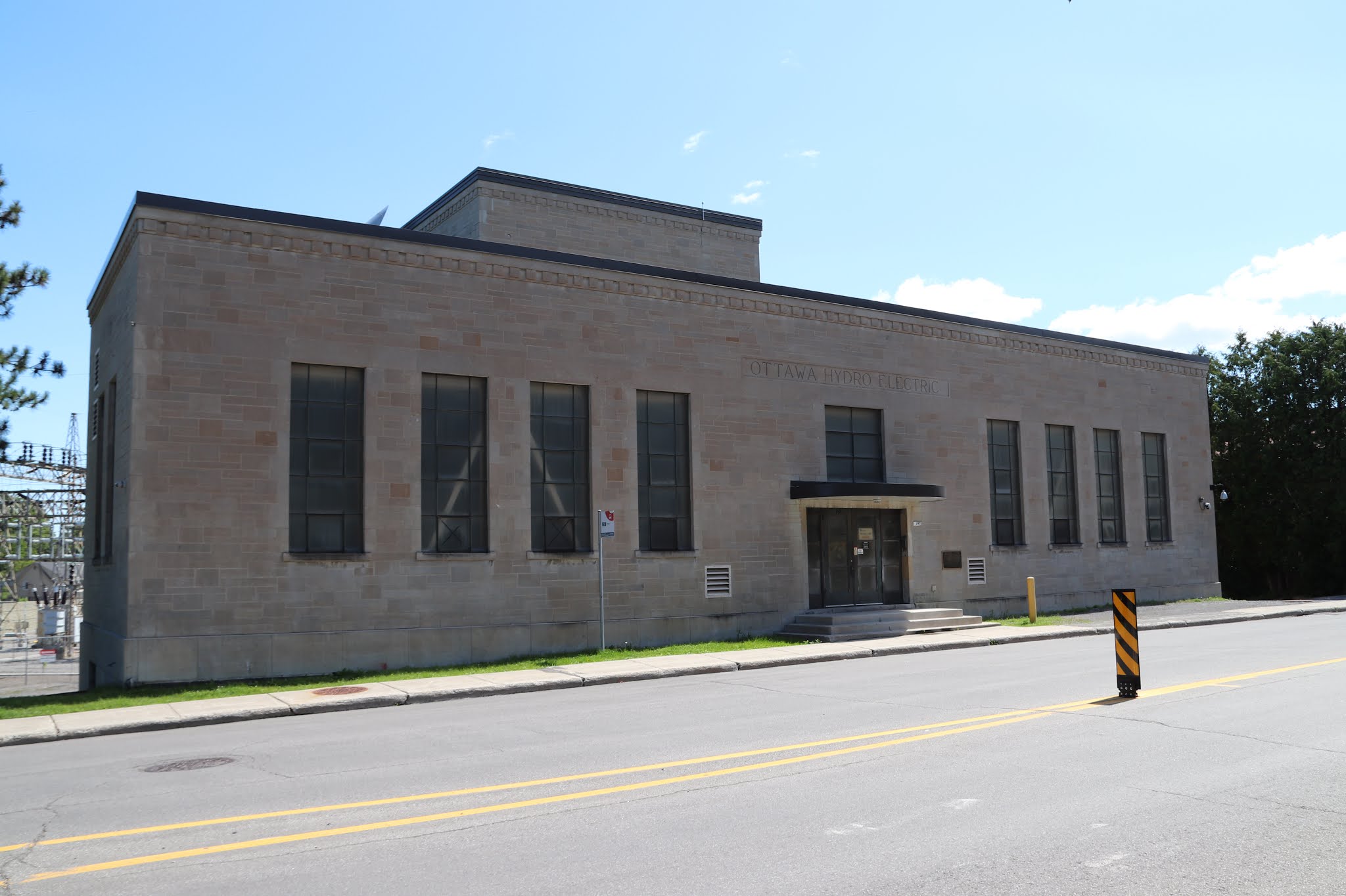
The plaque commemorating Slattery's Field occupies the wall of the Ottawa Hydro Electric building on the south side of Riverdale Avenue between Main Street and Glenview Avenue.


SLATTERY'S FIELD
In this area, once a cow pasture, the first aeroplane flights occurred in the Ottawa region. Between September 11th and 14th, 1911, Lee Hammond, flying a biplane performed before crowds attending the Central Canada Exhibition. On October 8th, 1913, William C. Robinson landed at Slattery's Field after flying from Montreal, the first flight between two Canadian cities. Both pilots had to contend with cows and horses, which shared this crude airfield.
PLAQUE ERECTED BY THE CANADIAN AVIATION HISTORICAL SOCIETY

SLATTERY'S FIELD
Cet endroit, jadis un pâturage, fut le théâtre des premiers vols aériens de la région d'Ottawa. Entre le 11 et le 14 septembre 1911, Lee Hammond survola la ville avec son biplan devant la foule qui assistait à l'Exposition du Canda Central. Le 8 octobre 1913, William C. Robinson en provenance de Montréal effectuant le premier vol entre deux villes canadiennes, atterrissait à ce même endroit. Les deux pilotes ont dû partager ce terrain d'atterrissage primitif avec les vaches et les chevaux.


Pindigen Park occupies a place surrounded by Wellington Street, Booth Street, Fleet Street and Lett Street.
Le parc Pindigen occupe un emplacement entouré par les rues Wellington, Booth, Fleet et Lett.

Curious about the meaning of "pindigen," I found this on the National Capital Commission's page about Pindigen Park. 'The park highlights Indigenous culture and heritage, and its name evokes the spirit of inclusivity and harmony among people. ‘’Pindigen’’ is more than a name, it is an invitation. It means: “Come on in! All are welcome here!”'


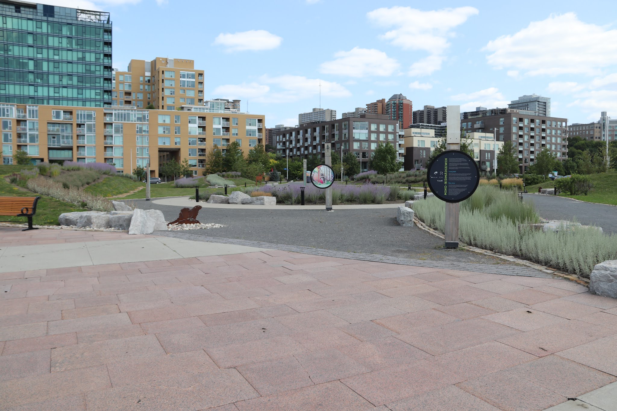


Mino-Bidmâdiziwin
Ânîn 'mino-bidmâdiziwin' ekidômagak kibimâdjiwowining konima kaye kidandanakîwining? Anishinâbeg wîn ikidowag pimâdizinâniwang mâmawe kagetinâm tidibâkamig. Akî, nibî, nôdin ashidj pemâdizidjig mâmakâdj nâsâb mâmawe ke-odamitâmagak, konima kaye kada-gogagizîmagadôn kakina.
'Ondaje wâkâhi Anishinâbe tinakîwinan Kitigân Zîbî Anishinâbeg ashidj Mâmîwininiwag Pikwâkanagâning kî-wîdôkodâdiwag kîjenindamiwâdj Kâ-mâmawosingin Wâbandahiwekân. Tâbishkodj ashidisinôn mâmawe kodagan Anishinâbe tinakîwinan.
Sylvia Tennisco kagi mizingigêtc. Tony Amikons ijinkazo kagi atsokanajin awêsisin. Nijin gwêndok anishnabêk ka kosabidimotc kickitowinni, nitim anichnabêk Pikwâkanagâning ka-pi-odisêwatc.
Living Well
What does "living well" mean in your culture or community? For the Anishinabe First Nations, it means living in harmony with the natural world. The land, water, air and people must be in balance with each other or the whole will suffer.
This park was developed in collaboration with the local Anishinabe communities of Kitigan Zibi Anishinabeg and the Algonquins of Pikwàkanagàn. Both communities are part of the greater Anishinabe nation. The illustrations are the work of Sylvia Tennisco. The animal representations are based on work by Tony Amikons. Both are Algonquin visual artists living in the Pikwàkanagàn First Nation community.
Bien vivre
Que signifie « bien vivre » dans votre culture ou votre communauté? Pour les Premières Nations anishinabes, cela signifie vivre harmonie avec la nature. la terre, l'eau, l'air et les gens doivent être en équilibre sinon l'ensemble en souffrira.
Ce parc a été développé en collaboration avec les communautés locales anishinabes de Kitigan Zibi Anishinabeg et les Algonquins de Pikwànagàn. Les deux connunautés font partie de la grande nation anishinabe. Les illustrations ont été créées par Slyvia Tennisco. Les représentations animales s'inspirent de l'œuvre de Tony Amikons. Tous deux sont des artistes visuelles algonquins qui vivent dans la communauté de la Première Nation Pikwàkanagàn.


Akî
Ondje Anishinâbe, enenindang akî kâwin eta ogidakamig, asinîn, ashidj netâwingin. 'Akî' awesînzag kaye ashidâdidâgozeg ebidjig 'indaje. Mâmawe netâwigingin, aswesînzag mîdjim ondâdizinâniwan, wîyagasî, âbadjitôwinan, anokî âbadjiitôwinan, keshigwâdegin, pimide ashidj mashkikî.
Land
For the Anishinabe, the notion of land is not limited to earth, rocks and vegetation. "The land" includes the animals who live on it. Along with plants, animals provide food, clothing, tools, weapons, sewing materials, oil and medicine.
La terre
Pour les Anishinabes, la notion de terre ne se limite pas au sol, aux rochers et à la végétation. « La terre » inclut les animaux qui l'habitent. Les animaux, ainsi que les plantes, fournissent de la nouriture, des vêtements, des outils, des armes, du matériel de couture, de l'huile et des médicaments.


Nibî
Nibî obimâdjîhigonâwâ kakina pemâdizidjig. Nîbina kîgônzag odôndendâniminâwâ, ashidâdidâgozeg kinôjeg, ogâwag, namegosag, omîdjimimiwâ kaye kîyâbadj Anishinâbeg nôngom. Apîch inâbadak mashikikiwâbo, agwindjinâbo, nibî andawenindâgod onje Anishinâbe mashkikî.
Water
Water sustains all living creatures. It is home to many fish, including pike, walleye and trout, which remain a food source for the Anishinabe today. When used in healing teas or baths, water is also essential to Anishinabe medicine.
L'eau
L'eau maintient toutes les espèces en vie. Elle abrite de monbreux poissons dont le brochet, le doré et la truite, qui demeurent aujourd'hui une source de nourriture pour les Anishinabes. L'eau est essentielle à la médecine anishinabe notamment dans les thés et les bains thérapeutiqus.


Pemâdizidjig
Misawenindang kidji-mâmawe ondamitâmagak akî, nibî, nôdin ashidj pemâdizidjig kichi-inenindâgodine ondje Anishinâbe obimâdiziwin. Ki-bi-ânike-mînidinâniwan eko ayândaso min tasobibôn. Nôngom, weshkinîgidjig Anishinâbeg kikinâmawâg ked-iji-odâpinamiwâdj tibâbâdjigewin apîch kego inanokîwadj, mâmandosewinan ashidj kâ-ânikeyâdjimonâdegin.
People
The desire for harmony between the land, water, air and people is central to the Anishinabe way of life. It's a concept that has been passed down for thousands of years. Today, Anishinabe youth are taught the value of balance through a combination of practical experience, ceremonies and oral tradition.
Les gens
Le désir d'harmonie entre la terre, l'eau, l'air et les gens est au centre de la vie anishinabe. C'est un concept qui se transmet depuis des milliers d'années. Aujourd'hui, on enseigne aux jeunes Anishinabes l'importance d'une vie équilibrée à travers une combinaison d'expériences pratiques, de cérémonies et de tradition orale.


Nôdin
Ondje Anishinâbe, nôdin odinâbadjitôn kanônâdjin kichi manito. Nîbina mâmandosewinan tôdamôg pate mâdjîyâpisâweg nôdinông. Ayamiyewinan mâdjîyâpaten konima kaye, kedinahigadogwen, tâ-âbadad 'patewîhidizowin', konima kaye pînichigan, onje pemâdizidjig kaye abinâsan.
Air
For the Anishinabe, air is a channel to the Creator. Many ceremonies involve sending smoke into the air. Smoke can transmit prayers or, depending on the type, can be used to "smudge," or purify, people and places.
L'air
Pour les Anishinabes, l'air est un conduit vers le Créateur. De nombreuses cérémonies impliquent la production d'un nuage de fumée dans l'air. Différents types de fumée peuvent transmettre des prières ou être utilisés pour purifier les gens et les lieux.