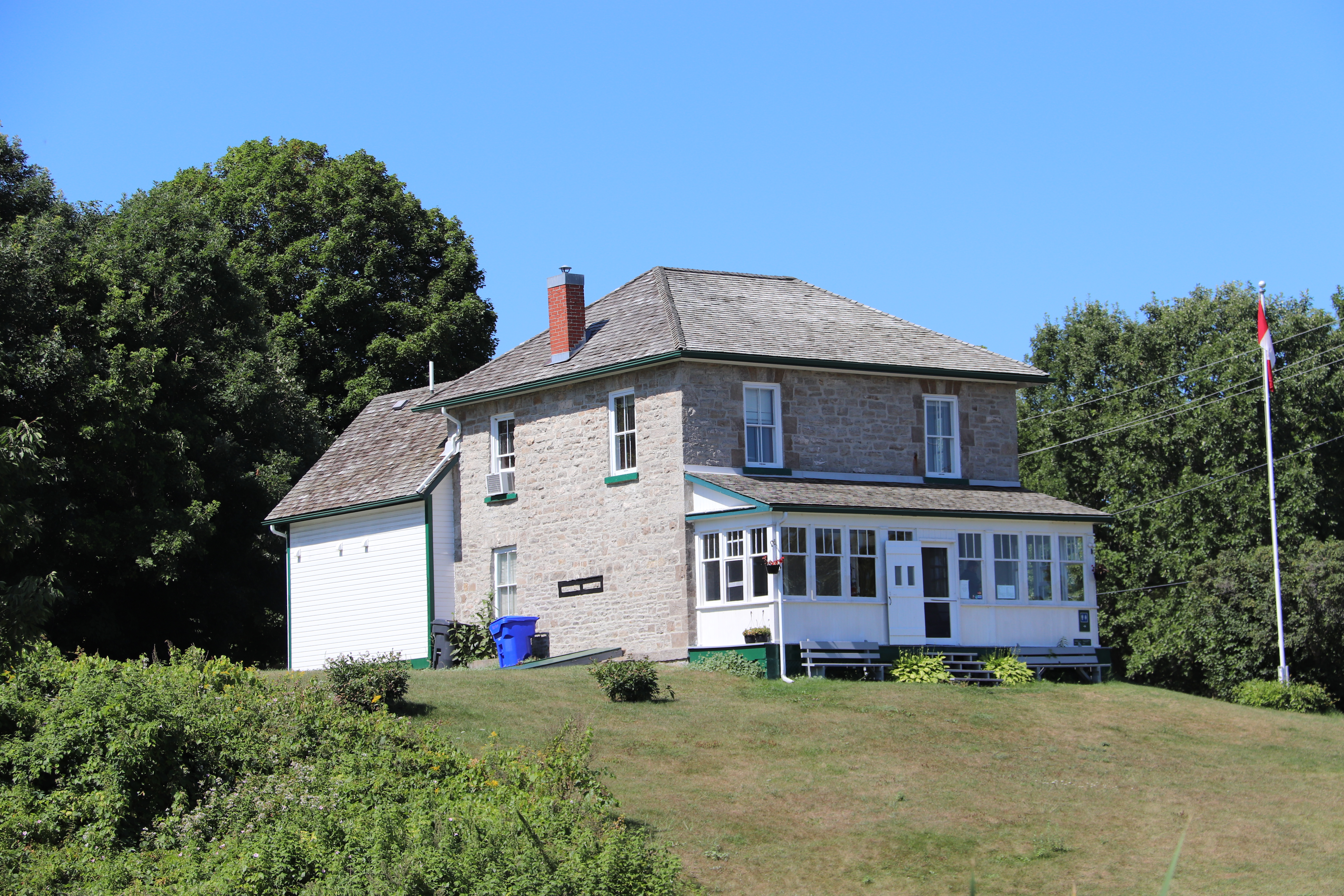
Kilmarnock lockstation occupies the north end of Kilmarnock Island southwest of Lanark Road 43 and accessible by Kilmarnock Road.

Parks Canada
Rideau Canal
National Historic Site of Canada
Kilmarnock Lock
Rideau Canal
National Historic Site of Canada
Kilmarnock Lock

Parcs Canada
Canal-Rideau
Lieu historique national du Canada
Écluse de Kilmarnock
Canal-Rideau
Lieu historique national du Canada
Écluse de Kilmarnock


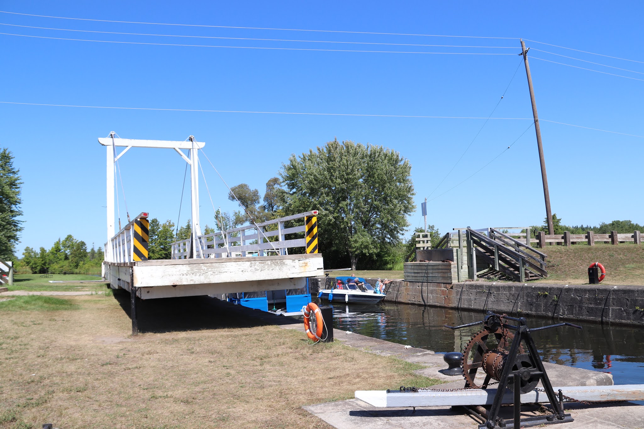
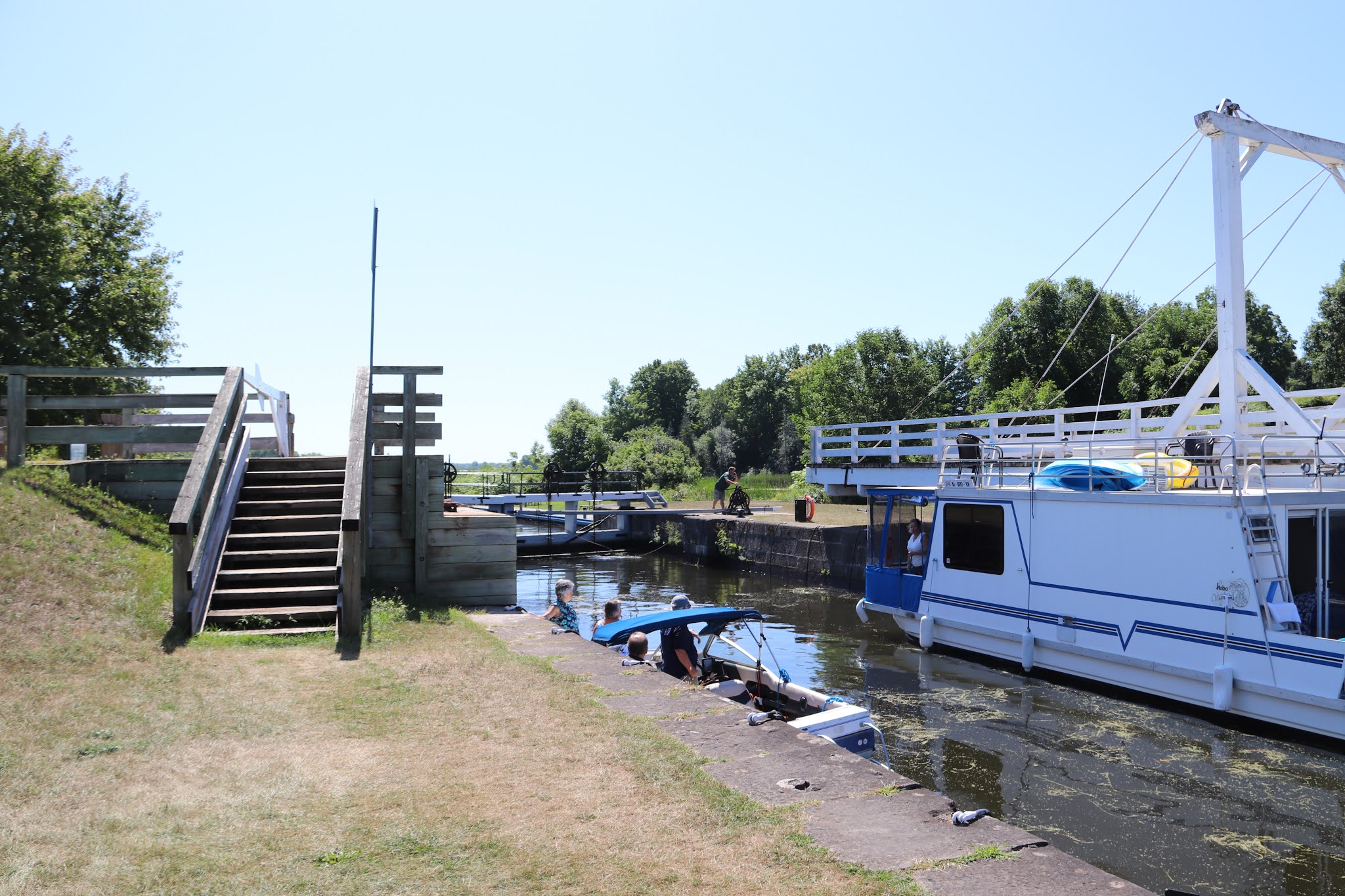
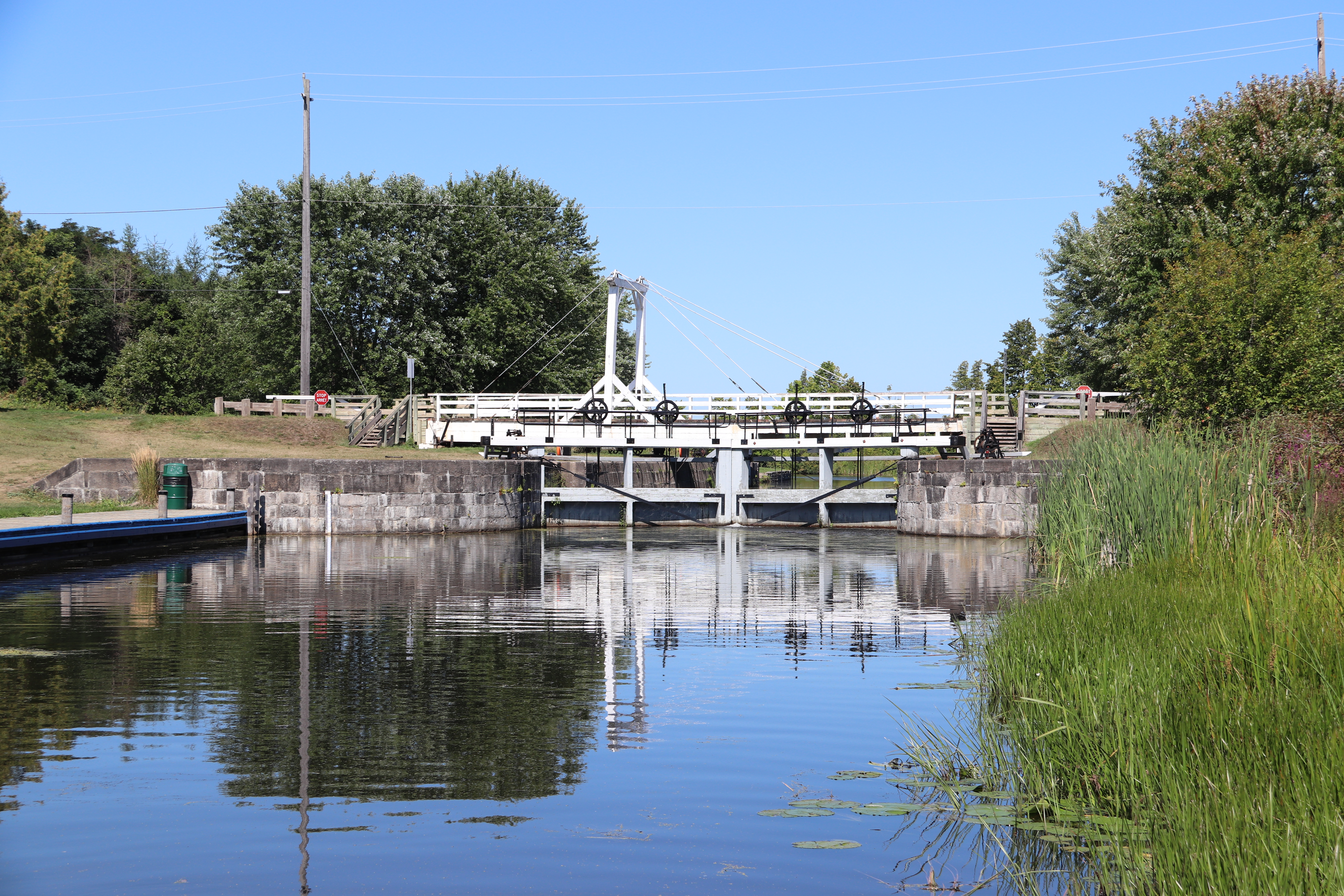
Lock 25 at the Kilmarnock lockstation has the lowest lift in the Rideau Canal system of 0.6 metres (2 feet). The overflow dam and weir cross the Rideau River under the road bridge some distance from the canal channel and lock. I could not find a place from which to photograph the upstream side. You can see from the downstream side that the overflow is quite gentle.


The photograph above, taken from the bridge, shows the Rideau River on the downstream side. The one below shows the upstream side, where the line of buoys warn boaters and swimmers away from the increased flow and dangerous undertow associated with the dam and weir.


KILMARNOCK
A short walk to the west, about where the dam now blocks the old channel of the Rideau, the Maitland family once operated a ferry giving he station its original name of Maitland's Rapids. With a rise of only two feet, this lock is little more than a hiccup compared to some in the system. Nevetheless, it's construction served to drown out a swamp and created the large lake on the upstream side, shallow as lakes go but deep enough for boats to navigate the three miles to Edmonds lock. Expensive excavation was thus avoided.
While construction was in progress a form of malaria swept through the workers. This disease was one of the main problems faced by Colonel John By and sometimes work on the entire system was brought to a halt for weeks on end. When the frightened workers on this site downed their tools, he repositioned the lock so that it could be built with less excavation and faster, hence reducing the toll of the fever. Colonel By was motivated by a genuine concern for human lives. He provided medical treatment noto only to the families of those employed, by helped the unemployed as well. This was a rare sentiment at a time when lives were cheap and when the expense had to be explained to the British Treasury.
Between 1826 and 1832, an old Indian canoe route along the Rideau and Cataraqui Rivers was transformed at the command of the British government from untamed wilderness rivers into the Rideau Canal. The purpose of this remarkable artery was to provide the British army with a safe route for supplying its inland garrisons, avoiding the direct but exposed route along the St. Lawrence, which only the disorganization of the American forces had prevented from being cut during the War of 1812.
The 202 km (126 miles) of waterway was made navigable by 47 locks grouped in 24 stations with their associated dams and weirs. The word was designed and superintended by the Royal Engineers, commanded by Lieutenant Colonel John By; the actual construction was done by local contractors.
Despite the blockhouses along the waterway, the role of the Rideau has always been peaceful. It was a busy waterway, carrying settlers and supplies into the growing settlement of the interior until the middle of the 19th century, when larger locks were opened on the St. Lawrence. At the same time, since the possibility of war between Britain and the United States was now unlikely, the British Board of Ordnance signed the system over to the colonial government of Canada in 1856. The period of the Canal's military administration was over.
Local commercial traffic remained important until the advent of the automobile and better roads about the time of World War 1. Since that time recreational boating has grown steadily so that now the system, well into its second century, is busier than ever.

KILMARNOCK
Un peu à l'ouest d'ici, la famille Maitland exploitait un bac, presque à l'endroit où un brrage traverse maintenant le vieux chenal de la rivière Rideau. C'est pourquoi cette écluse a déjà été appelée Maitland's Rapids. Sa chute d'eau atteignant à peine 60 centimètres. l'écluse semble miniscule comparativement à d'autres. Néanmoins, sa construction a servi à noyer un marais pour en faire un grand lac en amont. Peu profond mais assez cependant pour permettre aux embarcations de se rendre à écluse Edmonds, à environ 5 kilomètres d'ici. De Coûteux travaux d'excavation ont ainsi été évités.
Au cours des travaux, la malaria décima la main-d'œuvre. Ce fut une dure épreuve pour le colonel John By. Les travaux furent parfois interrompus pendant des semaines. Lorsque les ouvriers, affolés, fuirent les chantiers, il décida de construire l'écluse à un endroit qui exigeait moins d'excavation, réduisant ainsi la duré des travaux et le monbre des victimes. Se souciant véritablement des vies humaines, il fournissait des soins médicaux non seulement aux familles des travailleurs, mais aussi aux chômeurs. C'était un geste rare à une époque où l'on attachait peu de prix à la vie humaine.
Entre 1826 et 1832, une ancienne voie d'eau utilisée par les Indiens le long des rivières Rideau et Cataraqui fut transformée à la demande du gouvernement britannique en un réseau de voies navagables : le canal Rideau. Le but de cet ouvrage remarquable était de fournir à l'armée britannique une route sûre pour approvisionner ses garnisons. On évitait ainsi le Saint-Laurent, voie plus directe mais oussi plus dangereuse qui n'était demeurée ouverte qu'en raison de la désorganisation de l'armée américaine au cours de la guerre de 1812.
Le réseau de 202 km (126 milles) a été rendu navigable par la construction de 47 écluses regroupées en 24 postes. Les travaux ont été planifiés et surveillés par les Royal Engineers. Sous le commandement du lieutenant-colonel John By. Ils ont été exécutés par des entrepreneurs locaux.
Malgré les blockhaus qui se trouvent le long du réseau, le Rideau n'a jamais été troublé par la guerre. Ce fut un cours d'eau achalandé transportant colons et approvisionnement à l'intérieur des terres jusq'au milieu de XIXe siècle lorsque les grandes écluses du Saint-Laurent furent ouvertes à la navigation. Au même moment, la menace de guerre entre la Grande-Bretagne et les États-Unis s'étant estompée, le British Board of Ordnance céda le réseau au gouvernement colonial du Canada en 1856. Ceal mit fin à l'administration militaire du canal.
Le trafic commercial local demeura important jusqu'à l'apparition de l'automobile et la construction de meilleurs routes à l'époque de la Première Guerre mondiale. Depuis, les plaisanciers se sont faits de plus en plus nombreux, tant et si bien qu le réseau, qui en est à son deuxième siècle d'existence, et maintenant plus fréquenté que jamais.


The depth at the sill is 1.8 metres (6 feet). Within the navigable channels throughout the Rideau Canal system the minimum available depth is 1.5 metres (5 feet). Boaters with larger boats using the canal are required to have a set of charts. Two sets are available, one for Ottawa to Smiths Falls and another from Smiths Falls to Kingston.


At most of the lockstations the workers will leave the last outer gate open after opening it to allow boats to exit. There's a high probability the next boats to approach will come from the direction of the open gate. This saves work, time and wear on the equipment. The lockstations are continually in communication with each other. When boats leave a lockstation the next one in the system gets notified that those boats are on their way.


When approaching a lock, even an open one, boaters moor their boats and wait for the lockmaster to assign them their place in the lock.