Monday, September 10, 2018

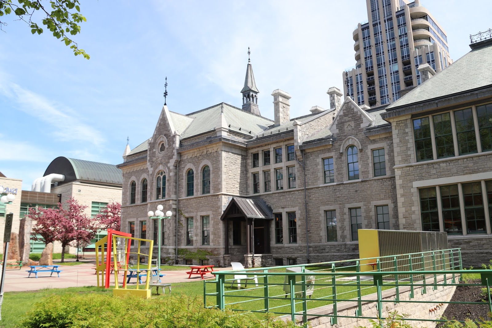
Ottawa Teachers' College

The former Ottawa Teachers' College occupies the location on the northeast corner of Elgin Street and Lisgar Street. On November 14, 1974, the building was recognized by the Government of Canada as a National Historic Site of Canada under the Historic Sites and Monuments Act.

L'ancien Collège des enseignants d'Ottawa se situe à l'angle nord-est des rues Elgin et Lisgar. Le 14 novembre 1974, le bâtiment a été désigné lieu historique national du Canada par le gouvernement du Canada en vertu de la Loi sur les lieux et monuments historiques.


OTTAWA TEACHERS' COLLEGE

The Ottawa Teachers' College, or Normal School, designed by the architect W. R. Strickland and built in 1875 by J. Forin, was the second institution of its type to be established in Ontario. The rear wing was added in 1879 to house a model school. The College continued to train teachers for Ontario until 1974. While the general massing of forms, with central and side pavilions, follows the 19th century academic tradition, the use of disparate architectural details including the pointed Gothic window, semi-circular Italianate Windows, Romanesque columns and Second Empire roof, reflects a spirit of eclecticism.

Historic Sites and Monuments Board of Canada.
Government of Canada - 1976


OTTAWA TEACHERS' COLLEGE

Conçue par l'architecte W.R. Strickland et construite par J. Forin en 1875, cette êcole normale fut la deuxième institution du genre en Ontario. Très massive comme la plupart des maisons d'enseignement du XIXe siècle, elle comprend un pavillon central et deux latéraux, et reflète dans son architecture l'éclectisme du temps: fenêtres gothiques ou semi-circulaires d'inspiration italienne et toit Second Empire. En 1879, on ajouta une aile à l'édifice pour loger l'école modèle. L'institution continua à former des enseignants jusqu'en 1974.

Commission des lieux et monuments historique du Canada.
1976 - Gouvernement du Canada




Thursday, September 06, 2018

Richmond Military Settlement Plaque

In Richmond Ontario, the Richmond Military Settlement Plaque stands just east of the two Richmond Fair plaques on the north side of Perth Street, west of Colonel Murray Street.


RICHMOND MILITARY SETTLEMENT 1818

In August, 1818, some thirty disbanded veterans of the 99th Regiment let by Captain G.T. Burke, arrived in newly surveyed Goulbourn Township. These formed the advance party of a military settlement planned and supported by the quartermaster-general's department. Here they laid out a town site named after the governor general, the Duke of Richmond. Storehouses were built, settler's cabins erected and the colonists provided with farm implements and rations. Under the general supervision of Lieutenant-Colonel Francis Cockburn, about 400 heads of families, including some civilians, were established in the settlement by the end of 1818, thus forming the first large community within the present Carleton County.

Erected by the Ontario Archaeological and Historic Sites Board.


Monday, September 03, 2018

Richmond Fair Plaques

In Richmond, Ontario, on the north side of Perth Street west of Colonel Murray Street stand a pair of plaques dedicated to the Richmond Agricultural Society and the Richmond Fair.


COUNTY OF CARLETON
AGRICULTURAL SOCIETY
1844 — 1944


PRESENTED BY
ONTARIO DEPARTMENT of AGRICULTURE
IN RECOGNITION OF
ONE HUNDRED YEARS SERVICE

SEPTEMBER 8TH 1944


RICHMOND
AGRICULTURAL SOCIETY
1844 - 199
PRESENTED BY
ONTARIO MINISTRY OF AGRICULTURE, FOOD
AND RURAL AFFAIRS
IN RECOGNITION OF
ONE HUNDRED AND FIFTY YEARS OF SERVICE